Showing posts with label habitat restoration. Show all posts

21 March 2013

Planning Underway for Missouri Backwaters Renovation


Planning is currently underway for two projects that will renovate backwater habitat along the Missouri River. One site is on the Nebraska-side of the river at Desoto National Wildlife Refuge. The other is at Wilson Island State Recreation Area.

Partners with the Army Corps of Engineers on these projects are the U.S. Fish and Wildlife Service and Iowa Department of Natural Resources.

About 25 people attended the first public scoping meeting — held at the refuge visitor center the evening of March 19 — where information on the project was explained, and officials were present to answer any questions, said David Crane, an environmental resources specialist with the Corps. There was an opportunity for attendees to provide any comments.

The Wilson Island site is associated with an existing backwater along the eastern boundary of the area. The Desoto Bend area is a relict backwater area.

There are numerous expected benefits, Crane said:

"The purpose of site-specific Missouri River Recovery Program Shallow Water Habitat (SWH) projects such as those at Wilson Island State Recreation Area and Desoto National Wildlife Refuge is to restore habitat for and population sustainability to federally endangered pallid sturgeon and to mitigate the loss of fish and wildlife habitat that occurred due to construction of the Missouri River Bank Stabilization and Navigation Project. SWH also provide nursery and refuge environments for young fish and foraging areas for other native fish, conditions in SWH environments are able to produce high amounts of macroinvertebrates and plankton which feed pallid sturgeon and other native fish and wildlife. As native wildlife communities are established in these restored environments recreational benefits are also derived by people who enjoy fishing, hunting, hiking, taking insect photographs, etc.

Final design for the two projects is still being evaluated, Crane said. Once a final plan is prepared, it will be available for public review.

"Final plans and specification are expected to be ready to be advertised by the end of August 2013, with construction beginning after the contract is awarded. Once construction begins the contractor will be given 12-24 months to complete the project. The anticipated construction cost of the different alternatives currently ranges between $3.0 million and $4.9 million, though these figures are based on order of magnitude estimates and final construction costs will be based on final project design which public and agency input can help shape."

The Corps of Engineers will pay all project costs, since it is a Missouri River Recovery Program habitat creation effort (shallow water habitat and emergent sandbar habitat).

Comments on the project may be mailed to U.S. Army Corp of Engineers, Omaha District, ATTN: CENWO-PM-AC (David Crane), 1616 Capitol Avenue, Omaha, NE 68102-4901; or via email to david.j.crane [@] usace.army.mil

"We are taking comments between now and about the end of May- the end of the public comment period depends on when the draft environmental assessment. A public notice will announce the timeframe of the assessment comment period, but comments are welcome before that announcement. If there is an optimal time it would probably be after the draft environmental assessment goes out - that way folks have some substantive content to comment on."

Images courtesy of the Army Corps of Engineers.

31 January 2013

Breeding Birds Appreciate Sandhill Refuge Habitat

It took some time for local birds to respond and take advantage of a habitat conditions at Crescent Lake refuge.

A renovation project — involving bulldozer work to create two islands — occurred at Goose Lake ca. in 2005-2006, by the U.S. Fish and Wildlife Service, the federal agency which owns and manages the refuge in Garden County, Nebraska.

Most recently, the site was appreciated by many Double-crested Cormorants.

About 50 pairs nested, and young were raised during the 2012 breeding season, said Marlin French, an refuge biologist. Refuge staff observed fledglings, although there were no particular surveys.

"The original island disappeared below the waters in the early 1990s," he noted, so cormorants "nested in other areas including goose tubs and other loafing structures."

Piping Plover have also taken advantage of the island habitat at Goose Lake. These small shorebirds nested on the island in nested on the Island 2008-2009, and along the road in 2010, according to refuge records.

There are known observation records from 2006, 2007, 2009 and 2010. Previous breeding records from the area are known for the 1990s at nearby Bean Lake.

This is an species of concern for the Great Plains region, and to have them occur at this refuge is significant.

Nesting by this species is "a bonus", French said during a phone interview.

In the first few years following renovation, numerous American Avocets nested at this place in the middle of the lake. There were as many as seventy nests in 2007, French said, and they did successfully raise young.

"During the period of record wet years of 2009-2010," the avocets went elsewhere, French said. The small island was completely inundated by higher water levels in 2010.

The small Island once again appeared above the lowering water in 2012, allowing the cormorants to nest. Currently, in late winter of 2013, the island is obvious amidst the lake, French said.

Hopefully there will be nesting habitat this season that can be "appreciated by the birds," according to a perspective conveyed by the refuge biologist.

12 November 2012

Corps Habitat Development Continues Along Missouri

In continuing to restore habitats along the Missouri River, the Army Corps of Engineers has several notable projects recently completed or underway.

Details for these projects were provided by Kelly Crane and Luke Wallace, both actively involved with the habitat restoration efforts by the Omaha District of the Corps.

Projects completed or underway, include:

1. Deer Island, on the Iowa side of the river at mile 672 (just above the confluence of the Little Sioux River), and located on property owned by the Iowa Department of Natural Resources: is a major channel top width widening project designed to create shallow water habitat along the main channel border. The top width of the river will be increased up to 400 feet in places to establish a "bench" of shallow water adjacent to the primary river channel. This project was started in 2012, and will be completed in 2014.

Deer Island project, October 2012. All images courtesy of the Army Corps of Engineers.

2. Sandy Point, on the Nebraska side of the river at mile 657, and completed in 2011: a new shallow water habitat was created that that consists of two chutes and multiple tie channels connecting the chutes to the river. The setting will provide an several features, according to Wallace, including an increase in the depth and flow diversity of the off-channel river waters, create more edge habitat and provide places for woody debris piles to develop.

Sandy Point project, October 2012.

"This is a complex project not like any that have been previously done," said Wallace, especially noting it is "unique for having two chutes. It is like a research project," with extensive preliminary modeling done to determine the best method of implementation. Physical and biological monitoring will be done to evaluate the results, he said.

3. Tobacco Island, at river mile 588: a modification to an existing chute to change the location of the inlet and route the chute away from a rocky outcropping to allow the chute develop over the years as designed. This project is at the William Gilmore WMA, just downstream from Plattsmouth. The first chute created could not widen as intended due to the rock strata near the bluffs, so a chute is being dredged further to the east and closer to the river. The first chute will revert to backwater habitat, Crane said.

Tobacco Island project, October 2012.

Other smaller projects required due to changes in channel features caused by the 2011 flood, were done at Fawn Island, Middle Decatur Bend, and Tyson Bend, said Wallace. This primarily involved dredging to reconnect features to the river hydrology.

The corps plans to work on the following project in the coming months, Crane said.

1. Little Sioux Bend, in Nebraska at river mile 668: "create a chute with multiple tie channels similar to the Sandy Point project.


Little Sioux Bend project site, October 2012.


Little Sioux Bend project design, October 2012.

2. Boyer/DeSoto National Wildlife Refuge, on the Iowa side of the Missouri at river mile 644: a shallow water feature will be created on refuge lands, in conjunction with the U.S. Fish and Wildlife Service. A planning meeting for this project occurred November 9th.

3. Glover's Point, on the Nebraska side of the river on Winnebago Tribe land at river mile 712: a backwater area will be established, including a connection to river hydrology, to what had been a chute project. High river flows in 2011 blocked the upstream end of the chute, Crane said. The Corps is working with members of the Winnebago Tribe to revise the project features.

Each of these projects are required to mitigate the loss of habitat due to construction of the Missouri River Bank Stabilization and Navigation Project.

Project Evaluation

A reconnaissance to evaluate the status of the river and mitigation projects from Rulo, Neb. to Sioux City, IA, occurred on October 16-17th.

Fifteen people participating in the helicopter flights included Corps engineers, biologists and construction representatives responsible if the design and function of the projects, along with representatives of the Iowa Department of Natural Resources and Nebraska Game and Parks Commission.

They had an opportunity to look at different construction, hydrology, recovery and environmental components along the river, according to Wallace. And to in particular:

  1. evaluate current river conditions subsequent to the 2011 flood;
  2. determine the status of site repairs done earlier in the year to repair flood damage;
  3. review work completed or underway at project sites;
  4. see where levee repairs had been done, and to get a perspective of the borrow sites where dirt was removed to repair the levee structures. In some cases, where public land was available, the levees were moved a further distance from the primary river channel. At other sites, the excavation of dirt necessary for the new levees, meant new wetland habitat was developed, with hundreds of acres created overall.
  5. consider locations for potential new projects.

During the survey, thousands of documentary photographs were taken that visually convey the river condition setting along the entire distance.

These flights, done every October, "provide a great perspective and a good overview," Crane said. "They are beneficial because they allow those responsible for the projects to see them all in one day. The two state agencies are very important partners with the Corps and participate in selecting, planning and designing projects" in their states. The National Park Service is also a partner, along the Missouri National Recreation River, above Ponca State Park.

22 December 2009

Recent Purchase Provides Missouri River Management Potential

When the Corps of Engineers purchased about 600 acres at North Alabama Bend in July 2009, it bought a tract that will provide further opportunities to manage habitat along the Missouri National Recreation River.

Area map of the North Alabama Bend tract, with the boundary shown by the red line. Image courtesy of the Omaha District office, U.S. Army Corps of Engineers.

The "tract of land was purchased by the Corps' Missouri River Recovery Program for restoration efforts to preserve riparian habitat," according to Kelly Crane, a program manager with the federal agency. "This parcel was attractive because it is a large, undeveloped piece of land that lends itself to preservation and is bordered on the south by the Missouri River for a little more than one mile and bordered on the east by Highway 19."

"The land features some variation in elevation which allows for both uplands and lowland plants," Crane said. "There are over 300 acres of maturing cottonwood forest (along with some other mixed trees). There is some cedar encroachment on the land, but the Corps will work to remove" this invasive species. About 200 acres of grasslands will be worked to restore native species of flora and fauna.

The property will also be conducive to restoration of sandbar habitat and possibly a backwater restoration, Crane said.

"The Corps will work with a multi-agency team consisting of the U.S. Fish and Wildlife Service, the National Park Service, the States of South Dakota and Nebraska, and many other agencies that will cooperatively determine the ultimate use of the property."

The North Alabama Bend Property was purchased for $3.4 million.

North Alabama Bend was named for the 220-ton steamboat of the same name that wrecked on October 27, 1870.

"There is a steamboat wreck approximately seven miles upstream that historians believe may be the North Alabama," Crane said. "The wreckage is not located on this site."

This tract is currently open for walk-in public access.

04 November 2009

Imperiled Species to Benefit From Sandbar Habitat Creation on Missouri River

The latest project by the U.S. Army Corps of Engineers to create an expanse of sandbar habitat for imperiled terns and plovers will get underway next spring on the Missouri River near the Niobrara River confluence.

The created sandbar will be 37 acres in size, and situated at Missouri River mile 842, across from the "Old Townsite boat ramp," near Niobrara, Nebraska, according to Corps officials.

This site was selected because of its former use by Least Terns and Piping Plovers, and since it has areas of natural sand accumulation, according to Kelly Crane, a biologist and manager of the Emergent Sandbar Habitat Program of the Corps. "There are already large, submerged sandbars at this location. When sandbars persist in an area for several years, vegetation encroaches to the extent where the birds will no longer use them. Birds can no longer easily see approaching predators and no longer feel safe and will abandon the sites. The Corps capitalizes on these existing, vegetated sandbars by performing vegetation removal and habitat enhancement."

"The 842 site and staging area as it looks today. 842.09 is looking from slightly upstream looking downstream from the NE side towards the SD side." Images courtesy of the Army Corps of Engineers.

A picture of the road to the staging area parking lot (the Niobrara Townsite Boatramp).

Tern and plovers have not used this sandbar for a couple years, Crane said.

"On September 25, 2009, a construction contract was awarded to Western Contracting Corporation of Sioux City, Iowa to construct a 37 acre sandbar," Crane said. "Dead vegetation will be cut and removed to the extent possible and the sandbar will be overtopped with approximately 1-2 feet of sand, as the contractor will dredge shallowly submerged sand and pump it on top of the sandbar. The sand will be reshaped to designated elevations so it will be at varying elevations suitable for nest sites of the plovers and terns.

"The contractor will begin work as soon as ice conditions leave Lewis and Clark Lake and can work until April 15th. April 15th is approximately the date when the terns and plovers will start making their way back to the area for the 2010 nesting season. The contractor will then suspend work until mid- to late-August 2010 when these birds will leave the area. The contractor must have all the work completed by December 2010."

"The contractor will use the Niobrara Townsite boat ramp area to stage and launch equipment," Crane said. "There will be a number of trucks that will transport the dredge, the dredge pipes, the dozers, scrapers, and other earth moving equipment. Barges will carry the equipment out to the sandbar complex."

The elevation of the sandbar will be high enough to "enable normal operation of the upstream system of dams, especially Fort Randall Dam near Pickstown, S.D.," according to a Corps press release.

A team of government officials decided where this new sandbar habitat would be established.

"The Emergent Sandbar Habitat (ESH) Program works with a multi-agency team from the U.S. Fish and Wildlife Service, the National Park Service (in reaches of the Missouri National Recreational River), state wildlife agencies and the Natural Resources Conservation Service when choosing sites for ESH construction," Crane said. "Members on the team from the Corps are engineers, biologists, project managers, construction representatives, real estate, and regulatory. The ESH multi-agency team usually meets in early spring prior to the birds' arrival in April to take a look at maps of the river reaches and Lewis and Clark Lake and to talk about past years' bird usage of each potential sandbar creation area.

"The team looks for areas in the river where the sand naturally accumulates. Sometimes these areas are partially emerged and sometimes these areas are completely submerged. From aerial photograph imagery we can see these naturally accumulating areas, even if they are shallowly submerged. The ESH program capitalizes on these accumulation areas. There are other selection criteria that have been identified over the years by various agency and public scoping comments used when choosing our sites. For example, we try to stay away from areas of high recreational usage, like popular picnicking sandbars. Once the birds utilize a sandbar, the Corps will restrict its use by the public during the time when plovers and terns are present. Examples of other selection criteria are, avoidance of the thalweg (main channel in the river), and avoiding sandbars that are attached to land to avoid any potential for mammalian predation.

"The team discusses potential localities and develops a prioritized list of sites for consideration. One of the goals of sandbar creation activities is to spread the habitat along the entire river section where these species breed, in order to avoid drawing a bunch of birds into one particular area that could be disastrously impacted by one hail storm, for example."

In 2009, summer thunder-storms had a deleterious impact on nesting activities of the plovers and terns, when hail destroyed nests and also caused bird mortality along a portion of the Missouri National Recreation River.

"There are currently two multi-agency teams that identify sandbar habitat for the ESH Program; one in North Dakota and one for Nebraska and South Dakota," Crane said in an email message. "The four reaches identified in the 2003 Amended Biological Opinion (BiOp) with habitat creation goals are 1). Below Gavins Point Dam, 2). Below Garrison Dam, 3). Below Fort Randall Dam, and 4). Lewis and Clark Lake.

"The entire process from site selection, design, National Environmental Policy Act (preparation of the Environmental Assessment), processing the Section 404 regulatory permit, selection of a staging area, to when construction actually begins is about 18 months," Crane said. "Construction contracts are awarded in the fall of the year so the contractor are poised to begin construction as soon as the birds leave the area in late August/early September. Construction cannot take place during the bird nesting season because there is a chance that if construction begins, the birds will choose the new sandbar as a nesting site and construction would have to be halted. The contractor works from approximately September until winter conditions prevent any further construction. Most projects can be finished within this time period, however, the contractor is allowed to complete the project in the spring if there is an early onset of wintry conditions in the fall."

The Army Corps of Engineers must provide habitat for the tern and plover under the amended Biological Opinion regarding the operation of the main stem dams on the Missouri River, which was issued by the U.S. Fish and Wildlife Service in 2003, according to a press release issued by the Corps for the Niobrara sandbar project. "Prior to the construction of the dams, bare sandbars were more abundant than they are today. Operation of the dams has altered the flows so that little new habitat is formed and the existing habitat is prone to erosion and vegetation encroachment."

Aerial Survey of Habitat

A recent aerial survey of riverine sandbars used by plovers and terns was done on September 16th 2009 by Corps officials to document the conditions of the habitat during this more normal flow regime.

The Corps has created several sandbar areas in recent years, and the survey was an opportunity to evaluate the conditions of these sites.

"These aerial surveys provide valuable information on any erosion that may be taking place on the sandbar and to assure the sandbars are performing as designed with areas of shallow water within the sandbars to provide additional plover forage opportunities," Crane said.

"The constructed sandbars are performing as designed and no areas of unanticipated erosion is taking place."

The Least Terns and Piping Plovers "have shown an immediate, favorable response to these habitat creation activities," she noted. "Both species utilize the newly created sandbars the first year they are available and continue to use the habitat until the vegetation becomes too thick for their tolerances. It is the Corps' responsibility to assure sufficient, barren sandbar habitat is available to the birds each year in all reaches. We are still behind the habitat creation curve and need to continue to create and maintain sandbars each year so we can assure compliance with the U. S. Fish and Wildlife Services Biological Opinion and to eventually recover populations of both birds on the Missouri River.

"The Niobrara sandbar project will continue the efforts of the Corps to improve and provide places for the plovers and terns to nest and successfully rear young which is essential for maintaining viable the Great Plains populations of these birds.

Pictures of riverine habitat created by the Corps of Engineers along the Missouri River.
Images and caption details courtesy of the Corps of Engineers.

River mile 761.3 is a 50 acre sandbar the ESH program built in the river below Gavins Point Dam in 2005.

RM 826 is a 200 acre complex built from 2006-2008 in Lewis and Clark Lake just downstream from the sediment deposition zone.

RM 791.5 is a 40 acre sandbar built in 2007. The picture is from the South Dakota side looking towards Nebraska.

RM 775 is a 44 acre sandbar built in fall of 2008 in the river below Gavins Point Dam, immediately downstream of the Vermillion Bridge.

RM 777.7 is a picture of the 15 acre backwater constructed in South Dakota in conjunction with the 76 acre sandbar.

RM 777.7_30 is a 76 acre sandbar complex built in the Missouri River immediately upstream of the Vermillion Bridge.

RM 795 is a 76 acre sandbar built in autumn of 2008.

RM 774 is a 49 acre sandbar built in spring of 2009 in the river below Gavins Point Dam, immediately downstream of the Vermillion Bridge.

27 February 2009

Efforts to Mitigate for Habitat Changes Continues Along the Missouri

Another new mitigation project along the Missouri River in Nebraska is currently underway on and near Boyer Chute NWR.

The Boyer Bend Billabong/Lower Calhoun Chute project is being done at a cost of $3.818 million dollars, using federal funds provided through a congressional allocation to the Army Corps of Engineers.

The project is for the benefit of the endangered Pallid Sturgeon, according to Matt Krajewski, Corps project manager.

This and other sites are selected through an extensive review and selection process, to include a review of historic maps and aerial photos showing the location of former riverine habitats. River engineers were also involved in the site selection process.

"This project meets the goals of mitigation without hindering the authorized uses of the river, including navigation and water supply," Krajewski said.

Project components include dredging an 11-acre chute and a 39-acre backwater along the west bank of the Missouri River at Boyer Chute Island, about 1.5 miles north of the south end of Boyer Chute along the west river bank.

The Lower Calhoun Chute project site north of Boyer Chute, has been designed to include multi water-levels of variable depths. The plan is to provide water habitat that will emulate conditions which occurred historically with the spring rise in the level of the water and the spreading of the channel into side channel backwaters and sloughs.

"This project will create habitat diversity by introducing historic water depths and velocities to the river channel," Krajewski said. "The Corps has been working with state and federal partners for years to develop viable projects, and this project is now underway after several years of planning and work with project partners. We worked closely with refuge staff to agree on a mutually acceptable project."

Krajewski explained that this project is one of many completed by the Corps as part of a biological opinion. It required creating a particular amount of habitat connected to the river, with water less than 5 feet deep and a flow less than 2 feet per second.

Projects have been done during the past two decades in order to mitigate for the ecosystem diversity prevalent along the Missouri River before it was channelized.

Clearing and grubbing - removing trees and getting rid of debris - is currently underway at the site of the billabong.

Equipment is being moved in via river barges rather than being transported across refuge lands. "This effectively minimizes disruption to habitats and wildlife," said Krajewski.

The project will be completed by March 2010.

"I look forward to finding Pallid Sturgeon in the new habitats," Krajewski said. [Boyer Chute billabong project site]

The Lower Calhoun Chute billabong project site is shown along the west river-bank on the right side of the aerial photograph. A billabong is known as a "a stagnant backwater or slough formed by receding floodwater."

04 June 2008

Island Birds to Thrive Following Removal of Invasive Stoats

Several species of native birds on wild Resolution Island, are expected to thrive following the removal of stoats to restore conditions more suitable for native flora and fauna.

"Small bush birds such as the New Zealand Bellbird, Tomtits and the kaka (a parrot), as well as the Kiwi, seabirds (Sooty Shearwaters) and the New Zealand Robin," said Murray Willans of the New Zealand Department of Conservation.

Once the predatory stoats - an invasive species present for more than a century - are removed, "birds will recover very quickly," said Willans. "Bellbird numbers should double within 12 months."

Annual bird counts will be undertaken on the island to monitor recovery of bird species once an initial trapping project is completed.

Traps to be used to remove stoats from Resolution Island. Picture courtesy of the New Zealand Department of Conservation.

The trapping will get started in July, with the positioning of 2500 traps, and "will be completed by mid-August, after which about 90% of all the stoats should be removed," Willans said. "A team of approximately 14 people will be involved in the trapping checks, and all the stoats will be kept for analysis."

Resolution Island, comprising ca. 21,000 hectares is part of Fiordland National Park, and within the 2.6 million hectare Southwest New Zealand World Heritage Area that was established in December 1990.

Stoats have already been trapped and removed from nearby Secretary Island, encompassing 8000 ha., also part of the park.

Both removal projects are financed by $7 million allocated in 2004 by the New Zealand government.

"The work was funded due to our growing confidence in the outcome and the work will provide a substantial island for threatened species management in the future," Willans said.

Following the trapping program on Resolution Island, traps will be "maintained on the island to stop re-establishment of stoats," Willans said, and will also be "maintained on the adjacent mainland to at least slow re-invasion."

Endemic New Zealand species such as the Kakapoo, a flightless parrot, and the Yellowhead are benefiting from other conservation efforts by the government in the Fiordland National Park environs.

24 April 2008

Wetlands Acquisition and Restoration Initiative on the Island of Kauai

Funding awarded through the North American Wetlands Conservation Act (NAWCA) will allow protection and restoration of imperiled wetland habitats on the Hawaiian Island of Kauai.

View of the lower Kilauea River. Courtesy photo.

The "project will acquire and conserve portions of a coastal estuarine wetland ecosystem," according to the grant details, "to prevent losses of two nationally declining wetland types, and one regionally declining habitat type, and will restore wetland acreage on public lands that will be protected in perpetuity”.

The following conservation goals have been identified for this project, which will acquire 12 acres and restore 128 acres of vitally important wildlife habitat.

1) Restore 23 acres of palustrine emergent wetland within the Huleia Unit of the Kauai National Wildlife Refuge complex. "The Huleia Unit of the Kauai NWR is designated as a core wetland area, which is essential for the recovery of Hawaii's endangered waterbirds." Wetland restoration will directly benefit the wetlands-associated migratory and resident birds which inhabit and frequent the Huleia Unit.
2) Acquire 12 acres within the Kilauea Coastal Preserve, a contiguous protected habitat area adjacent to the Kilauea Point National Wildlife Refuge (KPNWR), reducing habitat fragmentation for the endangered species that utilize the area. The KPNWR is a nesting and resting site for thousands of Hawaiian seabirds and the endangered Hawaiian goose. "The Kilauea Coastal Preserve is part of a patchwork quilt of managed areas being developed to protect rare and endangered species in the Kilauea River Watershed. State and county managed lands, a National Wildlife Refuge, and private land partners, combine to create contiguous habitat for wildlife.
3) Restore 105 acres of palustrine emergent wetland and upland coastal dune and strand habitat within Mana Plain State Wildlife Sanctuary. Restoration actions will support increased populations of migratory, wintering, and endemic waterbirds.

Picture of a pair of Koloa taken on Kauai. This species is expected to "benefit tremendously from this project, as Kauai is one of the last strong holds for this species." Photo courtesy of the Natural Resource Conservation Service.

The project was awarded $1 million dollars in funding from NAWCA, with additional match and funding sources of $2 million provided by the Kauai Public Land Trust, Ducks Unlimited and the Atherton Foundation. Additional partners in the initiative are The Nature Conservancy, Pacific Coast Joint Venture, U.S. Fish and Wildlife Service National Coastal Wetland and Pacific Islands Coastal Programs, U.S.D.A. Natural Resource Conservation Service Wildlife Habitat Incentives Program, National Oceanic Atmospheric Administration, State of Hawaii Department of Land and Natural Resources, Division of Forestry and Wildlife, and the Kilauea Point Natural History Association.

"Although wetlands cover less than 3% of Hawaii's surface area, they are extremely important because they support both plant and animal species endemic to the Hawaiian Islands," according to information in the NAWCA grant summary. "Protection and restoration of Hawaii's remaining wetlands is essential for the recovery of the endemic waterbirds, as well as to the survival of migrant waterfowl and shorebirds that visit the islands. Kauai is considered the last strong hold for the endangered Hawaiian Duck and Hawaiian Goose due to the lack of the Indian mongoose, an invasive mammalian predator."

Hawaii's wetlands function as valuable resources from several points of view, said Christina Ryder, a biologist with Ducks Unlimited. The land tracts involved in this project are important waterfowl habitats and refuges that "support rare and endangered Hawaiian waterbirds including the Hawaiian coot, stilt, gallinule, duck (Koloa maoli) and goose (Nene). They also serve as productive resource systems and nursery areas, supporting an abundance of fish and other aquatic organisms as well as providing recreational opportunities and acting as aesthetically pleasing natural landmarks.

"Better control and access to water is critical to restoring the Huleia and Mana wetlands," Ryder said. "Due to agricultural modifications at both sites the ecological function of these wetlands has been severely impacted. Better access to water to flood and dry fields is crucial to providing improved forage and nesting habitat for endangered waterbirds. By installing wells and adding piping infrastructure wetland managers will have access to water for wetland management, this will increase invertebrate forage, nesting sites and loafing areas for migratory and endangered endemic waterbird populations.

Map of the Mana project region. U.S. Geological Service map.

These projects could not come soon enough as there have been dramatic declines in wetland habitats in the Hawaiian Islands over the last 50 years. "The US Fish and Wildlife Service estimates that there were 22,487 acres of wetlands within coastal plains of Hawaii circa 1780." In 1990, an estimated 15,481 acres remained, a decrease of 31%. The agency also reported that logging, agriculture, grazing, military use, fire, and urban and residential development have claimed more than half of Hawaii's native habitats.

The importance of having different project partners is essential, Ryder added. "Partnerships between state, local and federal agencies allow a diversity of experts to collaborate on a project, as well as the ability to leverage additional resources that an individual agency may not be able to provide. By bringing together the State of Hawaii, the U.S. Fish and Wildlife Service and the Kauai Public Land Trust, this project is able to restore two key habitat areas and purchase additional habitats important for endangered species."

"Partnerships are the most effective way to create long term sustainable projects," Ryder suggested. "The more stake holders involved in a project means the more people who want to see the project succeed, and the more people that learn about wetlands and their importance to wildlife and the environment."

Public benefits expected for this initiative include "increased wildlife habitat and opportunities for wildlife-oriented recreation and environmental education, improved water quality, and increased shoreline protection, all of which will benefit the residents of Kauai.

04 April 2008

Hawaiian Refuge to Build Fence to Restore Habitat

Construction of a fence to restore habitats on the big Island of Hawaii by excluding unwanted livestock is pending, following the release of the final environmental assessment. Plans call for 88,500 feet of fence to protect 5,300 acres at the Kona Forest Unit of Hakalau Forest National Wildlife Refuge.

The selected alternative calls for “pig and cattle-proof fences (5-foot tall)” to be constructed “around the two lower units and pig, cattle and sheep-proof fences (7-foot tall)” to be “constructed around the upper unit,” according to a Fish and Wildlife Service news release.

The selected alternative would provide “a 15-foot wide, bulldozed access corridor along the entire fenceline.”

“Fence construction supports the management plan approved in 1997 when the Kona Forest Unit was established,” when a portion of the private Kai Malino Ranch was purchased. “Management is focused on endangered species recovery actions including biological research and monitoring, prevention and suppression of wildfires, and habitat restoration through feral ungulate control, non-native predator control, invasive plant control, and reforestation.”

“The Kona Forest Unit is located in the South Kona District, Island of Hawai‘i on the leeward slope of Mauna Loa at elevations between 2,000 and 6,000 feet,” the news release said.

[View of the Kona Forest]

View of the Kona Forest. Image courtesy of the Fish and Wildlife Service.

Forest types represented in the tract include a “mixture of introduced and native trees, shrubs, and grasses”; a mixture of koa (Acacia koa) and ‘ohi‘a trees and an understory of native shrubs and hapu‘u”; and a “mamane-sandalwood community” at higher elevations.

This forest “supports four species of endangered forest birds, the endangered Hawaiian hoary bat, and a high diversity of native plant species, of which several are threatened or endangered. Until 2002, the Kona Forest Unit also supported the last wild ‘alala or Hawaiian crow,” the news release said.

“The Kona Forest Unit also offers protected areas for other endangered faunal species, including the Hawai‘i ‘Akepa (Loxops coccineus), Hawai‘i Creeper (Oreomystis mana),‘Akiapola‘au (Hemignathus munroi), Hawaiian Hawk or ‘Io (Buteo solitarius), the Hawaiian hoary bat or ‘ope‘ape‘a (Lasiurus cinereus semotus) and an endangered picture wing fly (Drosophila heteroneura).”

Additional representative bird species, according to the environmental assessment, include: “several species of endemic forest birds including the native flycatcher ‘Elepaio (Chasiempis sandwichensis), and several Hawaiian honeycreepers including ‘I‘iwi (Vestiaria coccinea), Hawai‘i ‘Amakihi (Hemignathus virens), and ‘Apapane (Himatione sanguinea).

Although the Hawaiian thrush or ‘Oma‘o (Myadestes obscurus) has been extirpated from Kona, proposed habitat improvements in the project area could allow its future reintroduction onto the Kona Forest Unit. Pacific Golden-Plovers (Pluvialis fulva) occur as migratory winter visitors...”

Letters of support for the project were submitted by the State of Hawai‘i, local residents, and the Hawaii Department of Land and Natural Resources.

“The cost of the fence will be determined through a competitive bidding process that will take place after the fence corridor is cleared”, says James Glynn, acting Refuge Manager for the Big Island NWR Complex which includes Kona Forest and Hakalau Forest Units. “Once the fence corridor clearing project, scheduled to begin in 2008, is completed, the fence construction project will be started, likely in 2009.”

“Once the fence is constructed, and the feral ungulates removed, in 5-10 years, we should expect to see a dramatic increase in native understory plants and canopy density,” says Jack Jeffrey, Refuge Biologist. “The refuge will also be out-planting endangered native plant species that have been eliminated from the area by 100 or more years of ungulate presence. With the increased forest canopy density, native forest birds will find a safe haven to live. It is also likely that ‘Alala will also be re-introduced, but there needs to be many years of forest recovery before that happens,” Jeffrey said.

31 March 2008

Conservation the New Focus for Management of a Short-grass Prairie Tract in Colorado

A recent purchase of a large ranch in east-central Colorado will provide a unique opportunity to manage an extensive area of short-grass prairie - with riparian areas and playa-wetlands - for the benefit of a large variety of flora and fauna.

In March, The Nature Conservancy purchased for $10.3 million, the 23,300-acre Smith Ranch in Lincoln County, which was transferred to the Colorado State Land Board to create a 49,061-acre working cattle ranch in conjunction with adjacent holdings already owned by the state agency.

"Members of the recently formed Central Shortgrass Prairie Partnership are excited that the project will help conserve hundreds of playa lakes which are critical for migratory birds, particularly waterfowl," according to a TNC press release. The playas are also home for the Plains Leopard frog, with streams providing "excellent habitat" for the tiny Arkansas Darter fish.

"The conservation of the Smith Ranch provides significant opportunities to conserve this prairie gem teeming with at least 218 playas" said Mike Carter, coordinator of the Playa Lakes Joint Venture. "Playa lakes may be the most important wetland habitat type for waterfowl in the region hosting up to 20 species during winter and migration season."

Additional funding of $828,000 for the project was recently awarded to The Nature Conservancy by the U.S. Fish and Wildlife Service, through the North American Wetlands Conservation Act. Funding is for conservation and management of 1,903 acres of outstanding playa and wetland resources at the 49,236 acre Steel's Fork project site.

"Protection and restoration of this ranch will contribute significantly to the migration, wintering and breeding needs of priority migratory birds in all four of the National Bird Plans as well as other wetland-dependent species," said the FWS summary for the grant.
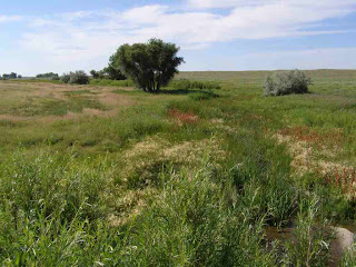
[Riparian and wetland area at Steel's Fork ranch]

Riparian and wetland area. All photographs courtesy of Chris Pague, TNC.

[Head of a creek at Steel's Fork Ranch]

Head of creek in the summer showing a no-grazing condition.

"The more than 200 playas in this, the western part of their prairie distribution, are dry most of the time," said Frogard Ryan, Central Front Range Grasslands Project Director for The Nature Conservancy. "After big rains they fill and suddenly support an unbelievable number of amphibians, invertebrates, and of course birds. When the filled playas correspond with spring or fall migration, they can host dozens of species of birds in large numbers. These playas are now managed to assure that wildlife benefits in addition to livestock.

"Burrowing owls and mountain plovers will be a focus of the ranch's management. These species are relatively common on the ranch and we want to see that they have the opportunity to always thrive here."

Additional changes in management, Ryan said, will be beneficial to migratory and nesting birds:

  • About 2,000 acres of riparian area and wetlands formerly used mostly by foraging cattle will now benefit birds as well as the livestock. These areas will be fenced to increase plant diversity as well as woody vegetation.
  • Restoring a playa wetland that had been dug-out and used as a cattle tank.
  • Removal of old ranch material from 12 acres of wetland and riparian area.
  • Changing the grazing regime to increase the height of grassland cover, making prairie areas more useful to Grasshopper Sparrows and Lark Buntings.

"While assuring that our legal obligations are met for water management, there is considerable flexibility in when water levels are raised and lowered in 2 small reservoirs," Ryan said. "These reservoirs will be managed to maximize the benefits to shorebirds, waterfowl, marsh birds, and wading birds. During migration there are hundreds of ducks, geese, coots, white pelicans, and other species that use these lakes."

"The ranch has populations of Northern Pintail, Mallard, Lesser Scaup, American Wigeon, Redheads, and will provide benefits for at least 12 NAWCA priority species including Western Grebe, American White Pelican, Sandhill Crane, Long-billed Curlew, Red-headed Woodpecker and Yellow-headed Blackbird, as well as at least 44 additional priority species from existing national and PLJV plans," according to the NAWCA grant summary.

"This is an exciting opportunity," the TNC press release said, "to manage a landscape with concrete goals that will result in a sustainable ranching operation that also demonstrably achieves conservation success for many bird species that depend on changes in management like those proposed on the Steel's Fork Ranch."

The management plan will be developed through a cooperative effort of the Colorado State Land Board, TNC, a representative from the agricultural community, with assistance from the Natural Resources Conservation Service, Fish and Wildlife Service and other experts.

The Steel's Fork tract "will be run according to a management plan for the working ranch to co-exist with ways to showcase Lincoln County as recreation and wildlife destination."

"The State Land Board is proud of this opportunity to demonstrate how ranching and conservation can work together for future generations," said Britt Weygandt, Director of the Colorado State Land Board.

"The nearby Bohart Ranch is a model that works with a similar framework and has been a successful cow/calf operation," according to the Conservancy. "The Bohart Ranch easily made the switch from private ownership to public ownership and is now under management by a local ranching family."

TNC has a 25-year conservation oriented management lease on the Bohart ranch, according to the group's press release.

Project partners will restore habitats to establish a "welcome mat" for species that depend on healthy wetlands and riparian areas.

"I am deeply grateful to the many local ranching families who have worked and treasured the prairie," said Ryan. "As a result of their hard work we have one of the most intact regions of prairie on the Western High Plains where conservation and ranching objectives are compatible. I look forward to learning from neighbors and residents about the area and exploring collaborative opportunities that will benefit the community, ranching and nature."

Within two years, The Nature Conservancy will establish an easement to prevent any future development on the recently purchased ranch.

"The 23,389 acre perpetual conservation easement will protect the portion of the ranch containing the majority of the Steel's Fork drainage including ca. 50 playas covering ca. 235 acres, ca. 13 stream miles, ca. 1,058 acres of marshes, other emergent wetlands, spring fed wet meadows, two reservoirs and three ponds," said the FWS grant summary. "The wetlands are intermixed with ca. 22,096 acres of native prairie that has never been converted to cropland."

A management lease option will provide complete management control to TNC. The State Land Board will contribute a six-month lease for a planning and restoration period. TNC will then acquire a 25-year management lease, according to the FWS grant application.

TNC will then sublease the agricultural management to a ranching family, according to the press release.

[Shortgrass prairie at Steel's Fork ranch]

Shortgrass prairie area.

[Steel's Fork reservoir area]

Upper reservoir area at Steel's Fork Ranch.

The Steel's Fork site, according to the TNC, "is the Eastern anchor in the Peak to Prairie project, an ambitious effort being undertaken by Colorado Open Lands and The Nature Conservancy, with support and participation of numerous local and state agencies and organizations, to conserve and link a landscape stretching from Cheyenne Mountain across the plains of eastern Colorado. The vision is to conserve this large intact prairie landscape, maintain military and agricultural uses and keep historic ranches intact while also conserving critical plant and animal habitat and providing extensive opportunities for recreational access."

New partners involved with the NAWCA portion of the project include the Colorado State Land Board, Sanborn Duck Club, Cheyenne Zoo, Tax Credit Connection (TCC), Hunter White Foundation, and Denver Botanical Gardens.

"The Sanborn Duck Club, formed in 1925, represents a group of 20 families from Colorado Springs," said TNC press release. "The Cheyenne Zoo, TCC and the private donors feel the project will provide benefits to their supporters and catalyze local efforts to place lands under conservation easements."

Additional partners, which did not providing matching funds were the Colorado State Land Board, Fish and Wildlife Service, Natural Resource Conservation Service, and Rocky Mountain Bird Observatory.

Extensive benefits for the public - identified by the federal grant application - as a result of this project include:

"Science staff will use the ranch as a model for grazing and wetlands management and share those lessons throughout their network. Downstream ranchers will benefit from better managed waterways which provide better sediment and flood control. The ranch will remain a working cattle ranch which is critical to the economy and culture of the area. The hunting community will benefit from access to high quality waterfowl habitat and the improved health of local waterfowl populations. The SLB and TNC will make the ranch available for school field trips, hunting and educational outreach efforts; the Sanborn Duck Club has been hunting the ranch since 1925 and plans to continue using the parcel for hunting outings and gatherings, as well as provide waterfowl monitoring. TNC is also pursuing including the property into an emerging Birding Trail project by RMBO, which is an effort to create local eco-tourism economic activity such as in nearby Lamar."

26 March 2008

Birds Will Benefit From Grant for Beetle Conservation

A federal grant to help protect saline wetlands for the imperiled Salt Creek tiger beetle is also expected to be beneficial to birds.

The $385,911 grant from the Fish and Wildlife Service will be used to help purchase an 80-acre tract of wetlands north of Lincoln.

The property has the "potential to provide habitat for migrating bald eagles, least terns and piping plovers," said Ted LaGrange, a wetlands biologist with the Nebraska Game and Parks Commission. "It also will provide potential habitat for over 200 other bird species, including migratory shorebirds and waterfowl" that occur on saline wetlands north of Lincoln.

The variety of migratory birds forage on the food resources that occur at wetland habitats, and use the places as a resting stop. Some species remain to nest during the breeding season.

"The 80 acre tract contains 25 acres of saline wetlands and 40 acres of saline hydric soils currently without wetlands that have the potential to be restored back to saline wetland," LaGrange said. "A stream crosses a corner of the property. Since this project will result in the restoration of saline wetlands, stream habitat, and associated uplands it will have other significant benefits in addition to providing habitat for the Salt Creek tiger beetle.

"Since a large portion of the property is on the floodplain it will provide for flood storage and conveyance. Also, due to its close proximity to the City of Lincoln, the site has the potential to provide significant recreational and educational benefits. These other uses will be managed to ensure that they are compatible with the wildlife and endangered species using the site."

Local non-federal sources will provide matching funds for the federal grant.

"The exact source of match funds has not be identified yet," said LaGrange, "but we anticipate using funds from a Nebraska Environmental Trust grant administered by the City of Lincoln. We may also use some funds from the non-federal partners" in the Saline Wetlands Conservation Partnership.

Negotiations to purchase the tract will be initiated soon, LaGrange said. If negotiations for the 80-acre parcel are not successful, then a similar tract will be sought. This will require Fish and Wildlife Service agreement, he said.

The grant is provided through federal Section 6 funds, which are used for acquisition of habitat for endangered and threatened species.

Only three small remnant populations of the Salt Creek tiger beetle occur on the a few remaining saline wetlands. More than 80% of the saline wetlands that once occurred in Lancaster County no longer exist, according to the FWS news release.

14 March 2008

Cedar Removal Underway at Cherry County Wildlife Refuges

Special funding of $10,000 from the regional office of the Fish and Wildlife Service will be used to remove unwanted cedar trees from grassland areas at the Valentine National Wildlife Refuge.

Planning is currently underway to define the places where the unwanted trees will be removed, said Todd Frerichs, assistant manager of the Fort Niobrara-Valentine refuge complex. A contractor will be hired to carry out the work this summer.

“Valentine refuge is an important sandhills prairie and wetland area, and removing cedar trees is essential to retaining grassland conditions for native birds,” Frerichs said. “Cedars reduce the quality of the prairie.”

Mechanical clearing is required since many of the invasive trees have grown too large for control by burning, he said. The cedar trees are spread out over a broader landscape, and the supplemental funding allows rehabilitation of an expanse of prairie.

Cedar trees were historically very rare at this tract which spreads across more than 70,000 acres, and is a significant migratory bird refuge in the region. [Cedar removal area in the Niobrara Valley near Valentine]

Cedar removal has also been underway at Fort Niobrara NWR northeast of Valentine. During recent months refuge staff have removed cedar trees in the Niobrara River corridor from the entrance bridge over the river and southward to near Borman Bridge Wildlife Management Area, a state owned tract.

The Nebraska Game and Parks Commission also helped to remove invasive cedars on the south end of Fort Niobrara refuge, adjacent to Borman Bridge WMA, Frerichs said. The state agency used a shear mounted on a skid-steer loader to remove trees at the wildlife area, and were able to also do additional work on the adjacent federal lands.

“Since the Big Rock fire about two years ago, people in the area are more aware of fire as a danger, and more receptive to the clearing of unwanted cedar trees,” said Frerichs. “We have received several positive comments regarding our removal work on the refuge along Highway 12, east of the golf course.”

Planning is now underway on how to best remove the invasive trees elsewhere in the Niobrara River valley at the refuge. An extensive growth of these trees has developed adjacent to the river and pose a threat to the desired oak, pine and cottonwood trees.

If a wild fire was to occur, said Frerichs, the large amount of accumulated fuel would burn so hot that it would likely destroy the desirable trees.

Portions of the area wanting to be eventually cleared are within the wilderness area of the refuge, and a special justification would need to be prepared to conduct cedar removal in these areas. Elsewhere on the refuge, buffalo have been effective in inhibiting the spread of cedar in areas where these animals graze. Regular controlled burns have also inhibited the spread of cedars into prairie areas.

Refuge staff are also considering how to best remove unwanted cedar trees invading the prairie tracts at the Seier NWR, south of Bassett.

"It takes a lot of work to remove invasive cedar trees,” Frerichs said, “but if we can find enough time and funding we can achieve a goal fairly quickly in an area and make a difference in re-establishing the desired grassland and woodland conditions.”

11 November 2007

Projects Funded by WRDA to Benefit Bird Habitats

James Ed. Ducey

An override of the presidential veto on November 8th, enacted the Water Resources Development Act of 2007.

“In today's historic veto override, Congress has kept its promise to restore America's Everglades and made an historic national commitment to the protection of more of America's most sensitive and valuable ecosystems, including the Gulf Coast, the Mississippi River, and the Great Lakes," said April Gromnicki, Audubon's Director of Ecosystem Restoration. "If there is a cause that merits a historic vote such as this, it's fitting that the cause be to restore some of our most special places before they are lost forever." 

The Legislation provides $23 billion funding for navigation, flood protection and ecosystem restoration. There is a plethora of projects from Alaska to Florida, and throughout the United States given in the 180-page plus bill.

Ecosystem restoration is slated for the Everglades, Mississippi River, coastal Louisiana and the Great Lakes, and Río Oeste, along the Salt River in Arizona.

The House legislation - H.R. 1495 - lists provisions for 178 projects, with 43 aquatic ecosystem restoration projects identified.

Examples of restoration projects given include:

  • Clam Bayou and Dinkins Bayou, Sanibel Island, Florida
  • Napa River Salt Marsh Restoration, Napa, California
  • Hudson Raritan Estuary, Liberty State Park, New Jersey
  • Hocking River Basin, Monday Creek, Ohio
  • Lower Colorado River Basin

The bill has seven small projects for improvement of the quality of the environment.

Mitigation, recovery, and restoration will be funded for the Missouri river and tributaries in Iowa, Kansas, Missouri, Montana, Nebraska, North Dakota, South Dakota, and Wyoming.

Passage of the legislation has been lauded by other environmental organizations.

“The passage of WRDA represents an important milestone in The Nature Conservancy’s efforts to protect and restore the Upper Mississippi River Basin,” said Michael Reuter, director of the Conservancy’s Great Rivers Partnership. “We applaud all of the senators and congressional representatives who recognized the benefits of this legislation – creating and enhancing habitat for native species, improving water quality, reducing the risk of flooding and increasing recreational opportunities.”

Most of these projects will be administered by the Army Corps of Engineers. Some projects will be carried out with local partners, which may provide additional funding.

Similar legislation was last enacted in 2000.

Water Resources Development Act

28 October 2007

WRP Projects to be Managed to Benefit Birds

James Ed. Ducey

Shore birds, waterfowl and upland birds will benefit from three recent Wetlands Reserve Program project sites in central Nebraska.

The Cuba WRP includes restoration of many potholes like the one in front of Joe Dush and Jim Lott [NRCS resource conservationist]. Native grasses have gotten a great start as evidenced by the reddish color" in the background. Images courtesy of the NRCS.

The private-lands projects, with a summary of their features as provided in an email report by the Lincoln office of the Natural Resources Conservation Service, are:

Bernard & Sharon Cuba WRP, Merrick County: “This 130.8 acres WRP contract was previously all furrow irrigated cropland, but these naturally wet soils will be much better managed as wetlands. Construction took place in the fall of 2005 by a contractor going through the federal bid process. Grass was broadcast seeded by Prairie Plains Resource Institute in the spring of 2006 with high diversity, local ecotype, prairie seed, 248 different species (34 grasses, 36 sedges & rushes, 21 legumes, 60 composites, 97 miscellaneous). Future management will include prescribed fire and grazing.”

"Joe Dush and Jim Lott are standing near one of many linear wetlands being restored on this site. Construction will be completed next Spring followed by a seeding of an appropriate wetland grass mix."

Albin & Mary Ziemba WRP, Nance County: “This 154.7 acre WRP contract was previously furrow irrigated cropland and some pasture, but again the naturally wet conditions means this land is best suited as managed for wetlands. The wetland restoration construction began recently this fall, but the wet soil conditions (as evidenced in the picture) will likely mean completion of the restoration in the spring of 2008. The wetland restoration plan includes 6166 feet of fence removal, capping 2 irrigation wells, 4 acres of invasive tree removal, 14,000 CY of excavation, and 98.7 acres of grass seeding. Future management will include prescribed fire and grazing.”

"... a small pothole wetland and the cleared brush piles in the background."

Chad and Christina Borowiak WRP, Nance County: “…trees have been removed this fall and wetland restoration and grass seeding will be completed in the spring of 2008. About 83.5 acres of this land was previously furrow irrigated cropland and the remainder was pasture. The wetland restoration plan includes 39 acres of tree removal, 4500 feet of fence removal, 19,516 CY of excavation, and 94.5 acres of grass seeding. Future management will be via prescribed fire and grazing.”

These project sites were visited on October 24th by Steve Chick, state conservationist with the NRCS. "Over the years I have received many positive comments about the outstanding work of our St. Paul staff, so I made this trip with high expectations... It is obvious that farmers and ranchers truly appreciate our NRCS assistance."

“Through the use of new tools (TERRA MODEL/survey grade GPS/ ATV's) we are now able to produce surveys, design, layout and checkout with considerable time/labor saving's,” Chick said. “What may have taken one person with a Total Station and 2 rodmen 4-5 hours to survey can now be done by just one person in one hour using the Trimble Survey grade GPS and we produce a better quality survey! Along with time savings in TERRA MODEL there is also a huge time savings by using the computer program for end products such as quantities, area, profile and creating a complete set of drawings. The final product is a much more professional set of drawings and designs … I was very impressed with the simplicity of the final designs that Joe [Dush] produces for the contractor to construct the wetlands.”

Dush is a Civil Engineering Technician with the NRCS.

These projects were managed by the Saint Paul office of the Natural Resources Conservation Service.

11 October 2007

Riverine Wildlife Habitat Created as Part of Bridge Construction

James Ed. Ducey

A project to replace the historic Meridian Bridge included dirt excavation that restored a riverine chute along the Missouri River channel.

Sediment was excavated from the river side channel to provide the fill dirt needed to construct a new approach to the Nebraska side of the bridge for Highway 81, south of Yankton. The bridge replacement project is being carried out by the Nebraska Department of Roads (NDOR).

"Construction of a bridge could potentially have negative effects on surrounding fish and wildlife habitat, but in this instance, it will actually improve habitat," said Robert Harms, a biologist with the Fish and Wildlife Service ecological services office in Grand Island.

About 10 acres of backwater area were restored, with work mostly finished this autumn.

The new backwater will improve habitat for the "federally endangered pallid sturgeon, Least Tern, scaleshell mussel, and for other fish and wildlife, including the sturgeon chub and false map turtle," according to a FWS press release. The tern and sturgeon will benefit from "small fish and insects that are often abundant in backwater areas, and provide a food resource."

Migratory birds that will benefit include waterfowl and wading birds, said Harms, mentioning the Belted Kingfisher, Great Blue Heron, as well as other water birds, such as the American Coot or Pied-billed Grebe. "The habitat will provide resting habitat for ducks and geese as they migrate in the spring and autumn. Much of this type of habitat has been lost over the years on the Missouri River," Harms said, "resulting in a drastic decline in the abundance and diversity of native fish and wildlife species."

Once construction of the piers for the new bridge is completed, an outlet will be excavated to connect the backwater area to the Missouri River channel.

The backwater area - along the Missouri National Recreational River - will be owned by the National Park Service, which is supportive of adding water flows through the site to create a flowing side channel chute, said Harms. Discussions to undertake this conversion should occur in the next couple of years.

The NPS also plans on building a trail system through the site, south of the chute, according to the NDOR project website..

During construction, the NDOR is taking measures to avoid any impact to endangered or threatened species. Specific items, according to a news release, include:

  • "Restrictions on the placement of material into the river and prohibition of pile driving or demolition activities during the critical spawning time for pallid sturgeon in the late spring and early summer;
  • "Reducing the length of the temporary causeway to avoid changes in hydrology that could impact spawning habitat and stationing of two spill kits at the construction site to contain accidental spills from equipment should they occur;
  • "Construction equipment, such as barges and tow boats, brought in from offsite locations were carefully inspected for zebra mussels, and invasive species that could severely impact the ecology of the river."

Surveys for the presence of the Least Tern, Piping Plover, scaleshell mussel and wintering Bald Eagle were also carried out to ensure bridge construction would not disturb these species.

NDOR "considers the backwater restoration project a win-win addition to the project," said Scott Brummond, a district environmental compliance officer with the agency. It was "a win for many fish and wildlife species and the environment and a win for the taxpayer and contractor due to the available fill material from this adjacent area being used in the embankment for the bridge approach."

This project was a collaborative effort among several agencies to develop an "environmentally friendly construction plan," according to the news release.

The Nebraska Department of Roads worked with the South Dakota Department of Transportation, U.S. Fish and Wildlife Service, National Park Service, Nebraska Game and Parks Commission, South Dakota Game, Fish and Parks Department, and the Federal Highway Administration.

The Meridian Bridge was built in the 1920s, and the new bridge is providing a replacement.

NDOR Yankton Bridge project website

18 September 2007

Federal Wetland Programs Help Develop Habitat Along the Missouri River

Missouri River wetland during flooding.

By James Ed. Ducey

Wetland programs of the Natural Resources Conservation Service are playing an important role in developing habitat for wildlife along the central Missouri River between Rulo and Ponca NE.

Since the Wildlife Reserve Enhancement Program's inception in 2004, nearly 10,000 acres have been developed for wildbirds and other local fauna along the Missouri River, according to agency personnel.

Wetlands within about one mile of the river qualify for this program that offers increased management options such as "linking" neighboring wetlands, staff said. Lands further from the river and through out the state may qualify for the Wetlands Reserve Program.

"Our success can be seen in the wildlife response following restoration," agency staff said. Typical wildlife habitat types developed on a contract area may include "Palustrine wetland habitat that is seasonally flooded. The area also included grassland habitat of tallgrass prairie, and woodland habitat of eastern riparian forest."

Annual monitoring efforts from one observation review indicate typical bird species which benefit include the Common Grackle, Dickcissel, Killdeer, Red-winged Blackbird, Pied-billed Grebe, Wood Duck, Mallard, Spotted Sandpiper and Ring-necked Pheasant.

Monitoring programs are accomplished as employee schedules permit and may not always be done at a time such as migration periods when the most diverse array of birds might be present.

Other fauna which benefit from the newly established habitat include amphibians such as bull frogs and Blanchard's cricket frogs.

One of the few public sites where birders can view the success of the project is at Boyer Chute, near Fort Calhoun, NE. Work here included recreating the old river chute, thus widening the river floodplain, agency staff explained.

Another public area is the Peru Bottoms site, east of Peru, now owned by the Nebraska Game and Parks Commission. East of Rulo, a project site is visible from the county road.

Other project sites are closed to public access since they are private property of the landowners.

"The success is in the numbers," an agency representative explained. There have been at least 93 WREP contracts with landowners:

2004 - 21 contracts for 1,680 acres
2005 - 35 contracts for 4,280 acres
2006 - 22 contracts for 2,000 acres
2007 - 15 contracts for 1,800 acres (through June 2007)
Total: 93 contracts for 9,760 acres

There has been $19.2 million committed to the program, through May 2007. The overall goal is to enroll 18,800 acres in the WREP.

Missouri River wetlands east of Nebraska City. All photos courtesy of the Natural Resource Conservation Service, Lincoln, Nebraska office.

"In addition to providing the typical on-site, wetland-related benefits, these lands under easement also contribute to the objective of riverine corridor restoration on a larger scale in future years," agency staff said.

Each wetland plan includes two primary steps.

There is restoration, which is the construction phase when water control structures are put in place. Typically, this included excavation of sediments. De-leveling a field, breaking sub-surface tile lines and seeding native grasses and forbs.

A management plan is then developed to guide agency personnel in providing maximum benefits for flora and fauna.

"The goal is to provide a diversity of hydrologic and vegetative conditions that benefit migratory and resident birds and other wetland dependent species throughout all seasons of the year. Special emphasis is placed on shorebirds, wading birds, and waterfowl."

Flood control is another primary reason for the wetland restorations.

The biggest targeting factor in the ranking to select program sites is the proximity to the existing river channel, agency staff explained. "This helps focus efforts on chutes, back waters, and oxbows.

The Wetlands Reserve Program (of which WREP is a part) has a primary objective to restore and maintain habitat for migratory birds and to address threatened and endangered species habitat needs where possible.

The NRCS continues to look for project sites. "We are continuously seeking and taking applications for wetland restorations. It is a not stop process. In FY 2007 for both WRP and WREP, we signed 47 contracts to restore 5,200 acres," agency staff said. Of special interest are wetlands that can be linked to establish a corridor along the river edge.

"For the Lower Missouri River WREP, lands in the floodplain within a mile of the river, that were previously wetlands, old river channel, hydric soils, etc., that can be restored to a wetland," are the current emphasis. "These sites have hydric soil types that would have hydrophytic vegetation if not previously disturbed. Many have been converted to cropland."

"Landowners can opt for a 10-year restoration cost-share agreement; a 30-year conservation easement, or a permanent easement, which has been the most popular selection, according to a NRCS news release.

"Efforts of the WREP and Army Corps of Engineers mitigation efforts have blended well," NRCS staff said. "Wetland restoration enrollments have come from both sources.

Probably the best example came this spring on a WRP (before WREP) site south of Plattsmouth. NRCS worked with the landowner on the wetland restoration. The Corps is involved with stream bank sloughing and shallow water habitat restoration and notching of the dike along the river which allowed high flows from the river into the wetland, relieving pressure flooding downstream while the wetland held back the water, slowing releasing it back to the river. Adjacent neighbors downstream have now enrolled wetlands."

Following the WREP project, the Corps has bought some of the wetland from the landowner as part of their mitigation requirements. The shallow water habitat is needed for recovery of the endangered pallid sturgeon.

Other agencies or groups involved in these projects includes the Nebraska Game and Parks Commission, Ducks Unlimited and local natural resource districts.

The Nature Conservancy is contributing funds to WREP in NE, and a wetlands restoration specialist was newly hired in June. In late May, the group received $80,000 from Cargill to support its activities. "The money will be used to complete an 85-acre restoration in Burt County," a press release said.

"Cargill is pleased to support the wetlands restoration, and would be doubly pleased if our contribution spurred interest among others to join in the effort," Eric Johnson, facility manager for Cargill's Corn Milling plant in nearby Blair, said in a news release. "This project fits perfectly with Cargill's approach to environmental stewardship."

Further information on WREP is available at the NRCS website.

Missouri River wetland scene.