Showing posts with label La Platte Bottoms. Show all posts

01 February 2013

January Tour of the La Platte Bottoms

It was a vividly cold, January day to be looking for birds, but it was the last day of the month, and plans might have negated common sense. The temperature was in the single digits, and there was a brisk breeze from the north meant an oppressive wind chill.

But purpose was the intent, and besides, someone else drove. It was a group endeavor to take a look at the La Platte Bottoms. There were eleven people within the big, red van filled with participants that first gathered at the Papio-Missouri Natural Resources District office at Wehrspan Lake. We then went forth, bundled within a variety of clothing, with layers of various sorts most prevalent. There was no especially distinctive hat.

The first bird of the outing was an American Kestrel along a highway corridor.

Upon arriving at the land eastward from La Platte, a single meadowlark was the first bird obvious. Nearby was a small flock of tree sparrows.

The tour of the bottoms continued eastward, and then along the levee. We went past Iske Place, on the west side of the Missouri River, where there are few remaining residents.

The NRD is moving forward with plans to buy Iske Place, and revert the properties to greenspace. It could be done with assistance of FEMA and NET grants. There is a similar intent for another another tract to the north at Elbow Bend. These places have been regularly ravaged by flood flows associated with the mighty Missouri River, so the time is apparent for the destruction to end.

Everyone got to see the upside-down crane — in the same situation as when the reported accident occurred earlier in the week — at the construction site for the new bridge over the Missouri River. A prominent sign indicating the number of accident-free days, had not yet been updated.

A couple of Bald Eagles were prominent because of their size. The two obvious were adults.

There were no deep drifts or any sorts of getting stuck problems because of the inches of snow a couple of days ago on the top of the levee. Marlin Petermann with the NRD, kept up an informative narrative. Especially notable features included local deer, former wells, a pump house and water control structures, fencing associated with a former dump, and prominent boundary markers.

An essential aspect were the colorful maps indicating property boundaries, landscape features which included a definitive indication of wetland areas, and other miscellany so essential to the day's endeavor.

Along the way, a suggestion to lead a bird hike was meet with vividly expressive silence.

Among the verbiage of the tour time, were some anecdotes about the local security man, who apparently has a deep well of stories. He was certainly attentive, as a nearby gate was quickly opened, though the route of the van was to go elsewhere.

With the fine mix of people riding within the big, red van, there were other ancillary topics of conversation, especially appreciated because it was a wonderful opportunity to listen and learn, with a purpose and strident effort to achieve a common goal!

The personal highlight of the afternoon drive was a Red-tailed Hawk, which had been sitting on a tree branch, until disturbed. It was hanging about an area on the north side of the Platte River where are significant portion of the native trees had been decimated by the flood, well remembered. The high-water mark was obvious on the tree trunks.

A short list of tasks was decided in the parking lot of a nearby convenience store, along Highway 75. A biologist with the Fish and Wildlife Service, quipped to me: "You're seeing how the sausage is made," in reference to how decisions can be made by a group sitting in a van on a cold Thursday afternoon. This was after a break where nearly everyone had a refreshing something to drink, whether it was a coke or a rootbeer or some other liquid.

There is so much more to convey about the results of the afternoon tour about the confluence of the Platte at the Missouri River. Specifics convey opportunity and the results of the group will be known, and appreciated in the future.

Special thanks to the staff of the Papio-Missouri NRD for sponsoring the tour with its lively discussion and attention to further efforts to conserve the greenspace at the La Platte Bottoms.

The bird species observed are the first known records for this locale, for January.

07 December 2012

Efforts Determined to Conserve Green-space at Platte Confluence

Further steps will occur to conserve a vitally important green-space on the north side of the Platte River at its confluence with the Missouri River.

"Issue no. 1" is to find a means to purchase property at the site from at two primary land-owners, Arcadian Fertilizer L.P. (a.k.a. PCS Nitrogen) and the Metropolitan Utilities District. Overall, the area spreads across more than 600 acres, southeast of LaPlatte along the Platte River side of a floodwater levee, eastward of the natural bluff and tree-line where there is a relict of a former oxbow, and south of LaPlatte Road and the under construction Highway 34 road alignment.

To help with this goal, a depiction of the site will be prepared — according to a verbal commitment — to suggest what amenities of other features which might occur at the site once it became public property.

In January, a "phase 1" report will be presented to the Back-to-the-River group, by the Bug Muddy Workshop, which this group focused on the Missouri River, hired in this regard. This document, according to two representatives, will be shared with attendees present at a Thursday afternoon, in the board room of the Papio-Missouri Natural Resources District.

It was a unique confluence of stake-holders. There was candid conversation by more than 30 people gathered to discuss the future of some land at the river confluence. The meeting which resulted from a personal request, was a lively discussion of issues of concern.

Attendees included several people from the Army Corps of Engineers, the Back to the River organization, the City of Bellevue including planning staff, three men from the Nebraska Department of Environmental Quality, an executive director of the Nebraska Environmental Trust, men interested in fish from the Nebraska Game and Parks Commission, Olsson Associates, staff of the Papio-Missouri NRD, a lawyer for PCS Nitrogen, PYRA Engineering since they are working on the levee situation, Sarpy County, United States Department of Agriculture and the Natural Resources Conservation Service, U.S. Fish and Wildlife Service, a couple of individuals interested in the place, and a representative from office of Senator Benjamin Nelson./P>

Attendees at meeting to discuss conservation of green-space at the Platte River confluence.

It was a meeting essential to determine the situation at the site and what it will look like years from now.

The meeting was hosted by the NRD at their office at Wehrspan Lake and they deserve accolades for making it happen.

Primary topics discussed, based upon an agenda issued before the meeting via email, were:

  1. potential levee setback, its reasons and rationale, and how it might influence down-river navigation on the Missouri River;
  2. site contamination issues, which comprised a large portion of the meeting's discussion;
  3. reasons and rationale for conserving the confluence area as a public resource because of its aesthetic, cultural, historic and wildlife significance now, and into the future.

It was certainly a pointed discussion, and once the opportunity to talk spread among the entire group, it was even livelier. Considering the number 1 issue expressed by a single man, it was somewhat obvious that a large majority, if not each person in the room, agreed upon the importance of conserving the green space at this place, based upon the confines denoted upon a map image shown upon the east wall of the room.

The meeting was about details. For the Army Corps of Engineers, any acquisition of the site is not a priority, due concerns agency staff have previously indicated.

It then became apparent that any effort to acquire the property should depend upon other sources, according to a common consensus. There are a number of optional opportunities, but any actual efforts are not known.

Based upon the overall consensus, there is a some hope that the setting will continue to be a space which the public could enjoy soon ... or at least during future years of bird-watching or other outdoor endeavors.

Nearby this site, the NRD has requested funds from the Nebraska Environmental Trust to buy properties at the former Iske Place, and convert the wooded area along the river into a green-space. The land was inundated during the Flood of 2011, and a common theme of discussion was about how the current owner would indicate a value for land subject to massive flooding.

30 October 2012

Considering Corps Decision Regarding the Platte Confluence

A recent meeting with staff of the Corps of Engineers provided details regarding the decision by the Army Corps of Engineers to focus resources from the Platte River confluence to other recovery sites along the Missouri River.

The Corps had been considering the purchase of a 399-acre land tract north of the Platte River, at the confluence with the Missouri River.

Particular reasons given by the agency to instead focus their limited resources elsewhere along the river, were:

1) Soil and groundwater contamination resulting from industrial activities associated with the PCS Nitrogen facility. A map graphic was provided which indicates several sites which exceed the allowable level of ammonia, notably on the upland along La Platte Road. Other spots in the immediate vicinity have lesser amounts, but with the groundwater flow towards the south and east, there is the potential for contamination downstream.

Yellow markers on the map indicate sites where the ammonia levels exceed an allowable limit.

Additional details were provided, which indicate, based upon a table of metal detected in groundwater at the site landfill, as indicated by the "Brownfield Phase II ESA Report" for the PCS Nitrogen facility. Metals listed as exceeding the Nebraska "VCP standard" were arsenic, barium, cadmium, chromium, lead and selenium.

Corps officials indicated they would not want to purchase a tract of land for which they may become legally liable for cleanup of site contamination, as repeatedly indicated by Corps staff, based upon their detailed evaluations.

Mentioned during the meeting was that the Nebraska Department of Environmental Quality recently issued a legal mandate for PCS Nitrogen to continue to monitor their property for contaminates for another ten-year period.

It was obvious, based upon the current situation as presented and agency decisions, that the contaminant problem is not going away.

There are no known efforts underway to remediate the situation.

2) A relict landfill comprising seven acres, occurs directly north of the tract which the Corps had been considered, and on the west edge of the area commonly known as the La Platte Bottoms.

This may also be a possible source of contamination.

The landfill area is indicated in the center of the map area. The white hatched area was the parcel the Corps had considered purchasing.

3) A drainage ditch from the PCS Nitrogen facility just east of La Platte runs eastward through the bottoms, and may also have contamination issues, according to a Corps official.

4) There are site improvement limitations at this site due to its proximity to the Offutt Airbase runway. There would be no opportunity to create shallow water habitat, because of the threat of bird gathering in the vicinity of planes routes. Any habitat that would attract flocks of waterfowl or waterbirds, might endanger airplane flights.

The limited extent of habitat recovery funds available to the Corps can be better spent at other sites, Corps staff said. There are numerous examples of other efforts to create habitat features along the river, including shallow water habitat, emergent sandbars, and other riverine features to promote the vitality of fish and wildlife. None of these management activities could occur at the parcel considered at the Platte confluence.

The proximity to the airbase has also imposed limitations on management options at the St. Mary's Island tract, previously purchased and on the Iowa side of the Missouri River. This site is a dryland, floodplain habitat, as a result.

An ancillary item discussed Friday morning was an effort to setback the levee along the north side of the Platte.

Any effort to move the levee northward from its current placement near the Platte River, would require Corp approval, and a NEPA review, according to a Corps official through a "408 approval."

Two items which would be considered in this review would be soil and groundwater contamination, as well as how the reconfiguration could influence the navigation channel of the Missouri, which the Corps is required to maintain by legal mandate.

It was apparent during the morning's discussion, that the Corps staff recognize the historic and cultural significance associated with the confluence. During the meeting, details were given to convey the bird history of the locale, to emphasize this topic. Also mentioned was the potential threat for industrial development that would destroy the bottoms, based upon perspectives presented in the Omaha and Bellevue media.

The Corps of Engineers has an ongoing responsibility to restore historic habitats and ensure the conservation of many Missouri River spaces. They would welcome the opportunity to be involved with other interested groups or agencies focused upon retaining a green-space situation at the Platte River confluence, according to comments from Corps staff.

The meeting was October 26th, downtown on the upper floors of the headquarters of the Omaha District office for the federal agency. Eight Corps staff were present. The meeting occurred because of a personal request for a meeting rather than a conference call.

Towards the end of the mid-morning meeting, it became obvious that there was a further need for discussions about the Platte confluence area, its status and future potential. One or another comment was that interested parties need to get together to share pertinent details, discuss particular issues, and — if this locale is to get the conservation is most assuredly deserves based upon many important facets — determine how to move this goal forward.

Conservation of the Platte Confluence involves many interested groups, yet some of the primary interests might learn more. There can be additional details presented.

The situation revolves about a property-owner, and the situation which now occurs.

A phone call to a Papio-Missouri NRD official was made in this regard Friday afternoon. It was another noteworthy conversation, with an emphasis that the NRD strive to have a meeting that would result in common interests being upon the same page.

Any meeting should include the Nebraska Department of Environmental Quality and U.S. Environmental Protection Agency, and several other entities with an expressed interest in this significant place along two rivers.

Lands at the Platte River confluence and the adjacent La Platte Bottoms are one of the most important sites along the Missouri River. In considering its future, this could be an essential aspect for its consideration.

The current perspectives are not consistent, though there are opportunities to alter the situation where-upon there could be a workable effort to conserve what is so obviously important at the Platte River confluence.

22 February 2012

Great Future Possible for LaPlatte Bottoms

Activities underway on several fronts provide key elements for the long-term conservation of bird habitat at the La Platte bottoms. Public details are sparse, but involve the Army Corps of Engineers, Back-to-the River, Papio-Missouri NRD and the Metropolitan Utilities District.

The property under consideration is currently owned by PCS and the Metropolitan Utilities District.

1) the Army Corps of Engineers is moving along in their series of steps which could lead to their purchase of 399 acres from PCS. They are currently undergoing a site appraisal. according to agency staff.

2) Back to the River has contracted with the Big Muddy Workshop to prepare a concept plan for the area around the confluence of the Missouri and Platte Rivers.

This effort has apparently included a presentation during the past two weeks to the Sarpy County Board and Bellevue City Council.

The confluence area includes additional tracts already under public ownership, including the Oreapolis mitigation site, Schilling WMA and the St. Marys Island tract on the Iowa side of the river as developed by the Corps and Iowa Department of Natural Resources. Another pertinent piece is Iske Place, a flooded out development adjacent to the Missouri River channel, where rebuilding will not be allowed following its decimation due to the flood of 2011.

This plan should be available in two-three months, according to a spokesman.

3) the Papio-Missouri NRD continues their interest in evaluating a levee realignment that would move the current riverside levee further "inland" to move portions of the bottoms to the river-side of the levee.

"There has never been a better chance to do this," said a spokesman for the NRD, and we "are doing everything we can to have it move forward."

4) A resolution of the "brownfield" study associated with the PCS is imminent, according to a NRD spokesman. The Nebraska Department of Environmental Quality has been evaluating a contaminant plume. It appears that a letter of no further action could be prepared, which apparently would require that there be no disturbance to the site landfill, nor that any groundwater wells be placed.

5) the Metropolitan Utilities District is moving ahead with efforts to construct a pipeline from their Platte South facility to the Missouri River, to avoid any discharge into the Platte River. The U.S. Fish and Wildlife Service has required this diversion to avoid any potential impacts to water quality in the Platte River, which might influence the closely considered Pallid Sturgeon.

The discharge from this pipeline would be intermittent, and not include any hazardous items, according to a MUD spokesman. The pipeline would cost from $1-2 million.

The pipeline would be routed along LaPlatte Road and then on the south side of the Highway 34 alignment currently under construction.

Potential Future

Each of these pieces can be combined in a common effort to conserve the remaining lowland at the LaPlatte Bottoms.

It's already a great place for birds — at least in the last couple of years when water was present to one extent or another — and can become a permanent conservation haven for wild things where visitors can get some glimpse of the natural character for which the Platte confluence has been recognized for more than two centuries.

Consider that the Corps of Engineers would buy the PCS property as a Missouri River mitigation property. MUD could shorten the length of their pipeline, and rather than going into the Missouri River, it would end in a water quality wetland, that would also create an intermittent wetland. This would reduce their construction cost while adding a habitat conservation aspect to their mandated project. The NRD would then have ready access to realign the levee, increasing the riverside lowland.

Intermittent water from the pipeline might flow into a water quality wetland basin, creating shallow water habitat. Perhaps something similar to the nearby Mid-America Energy Power Plant ponds, south of Council Bluffs.

Intermittent and shallow water habitats are very much lacking in this region of the Missouri River.

Might the setting attract some breeding Least Tern and Piping Plover? Both are birds entirely in need of conservation activities in this riverine region, according to government findings. Other shorebirds could also take advantage of shallow water conditions.

Offutt Airbase military officials might be satisfied, as there would be no new hazards to their aircraft since the wetland extent would be limited and woud actually attract fewer birds than a permanent marsh. Water conditions would continue to be ephemeral, as they are currently.

Cooperative Effort

Based upon the discussions regarding this locale, there was an obvious opportunity for further cooperative discussions. One land owner was not aware of activities occurring next to their property.

It is essential that rather than looking at the effort as one piece of a pie, that there be an effort to get all the pieces together so all of the interested parties are on the same page.

During conversations on this topic, the value of a broad perspective was conveyed, and especially that those involved with the LaPlatte Bottoms meet to discuss how they can cooperate to conserve the place.

There is a great future which could obviously occur with a common vision and focus to moving ahead.

12 January 2012

La Platte Bottoms Bird Observations During 2011

For the La Platte Bottoms, 2011 was a period of dramatic change. Especially prominent was construction associated with the new freeway alignment directly through its midst, and then came the great flood.

Birders on an outing for observe what might be about made the first known visit on February 20th. During March to the end of May, nearly twenty visits were reported. There were then three visit dates for June, and then the great flood occurred. It wasn't until October that any reports of the birds present could be done, as access had been restricted. The roads were blocked to watchers, though undoubtedly there were birds present.

There were at least 94 distinct species reported for this locality. The tally is skewed towards waterfowl and waterbirds, but a few observations of other species were indicated. Ducks were prevalent with an expressive variety of shorebirds also present.

One particular highlight was the Eurasian Wigeon seen in mid-May during the Sarpy County spring count. Phone call communication brought many local birders to the scene to appreciate this vagrant.

Among the waterfowl, was a hybrid Blue-winged Teal x Cinnamon Teal, also noted in earlier May. Other species noted only once or twice during the year include the Canvasback, Horned Grebe, Eared Grebe, Least Bittern, and Common Moorhen, which represent waterbirds. More than 30 Semipalmated Plover on April 30th, was a distinct occurrence, noted during the days when a Black-necked Stilt and Willet were also observed. In mid-May, a Stilt Sandpiper was added to the site bird-list for the year.

Other occurrences matching this criteria were the Cooper's Hawk, Golden Eagle, Peregrine Falcon, and others. During the year, a single recorded instance of the Downy Woodpecker in latter November indicates a bias in species occurrence. The same perspective applies to the availability of only one record each for the Eastern Kingbird, Western Kingbird, American Crow, as well as the Brown Thrasher. Add in single reports of the Savannah Sparrow, Lincoln's Sparrow and White-crowned Sparrow. There was only one report of the American Goldfinch.

Each of these birds are relatively common in the area, yet rarely noted for the La Platte Bottoms as the focus is on shorebirds, waterbirds and waterfowl.

If there was greater access to the habitat of the area -especially the wooded areas - there would be a subsequent increase on the species reported.

Without the contributions of many area bird watchers, as expressed especially on the NEBirds online forum as well as personal bird surveys, this report could not have been prepared. The birders' efforts are gratefully acknowledged and appreciated as important contributions to ongoing history of ornithology in Nebraska, and since they indicate the value of the wild habitat remnants within the valley of the Missouri River.

There have been at least 144 different species recorded at the La Platte bottoms, since 1980 when local birders realized the place was a site that attracted birds of interest to watchers of the various species. Considering 2010 and 2011, the tally is 117 species.

This is a list of the species known to occur at the wetlands north of the Platte River confluence, during 2011.

Species with an asterisk (*) are new
additions for this locality

Greater White-fronted Goose
Snow Goose
Cackling Goose
Canada Goose
Gadwall
Eurasian Wigeon
American Wigeon
Mallard
Blue-winged Teal
Northern Shoveler
Northern Pintail
Green-winged Teal
Canvasback
Redhead
Ring-necked Duck
Lesser Scaup
Bufflehead
Ruddy Duck
Pied-billed Grebe
Horned Grebe
Eared Grebe
American White Pelican
Double-crested Cormorant
Least Bittern
Great Blue Heron
Great Egret
Green Heron
White-faced Ibis
Turkey Vulture
Bald Eagle
Northern Harrier *
Cooper's Hawk
Red-tailed Hawk
Golden Eagle *
American Kestrel
Peregrine Falcon
Sora
Common Moorhen
American Coot
American Golden-Plover
Semipalmated Plover
Killdeer
Black-necked Stilt *
Spotted Sandpiper
Greater Yellowlegs
Willet
Lesser Yellowlegs
Hudsonian Godwit
Sanderling
Semipalmated Sandpiper
Least Sandpiper
White-rumped Sandpiper
Baird's Sandpiper
Pectoral Sandpiper
Dunlin
Stilt Sandpiper
Long-billed Dowitcher
Wilson's Snipe
Wilson's Phalarope
Red-necked Phalarope
Franklin's Gull
Bonaparte's Gull *
Ring-billed Gull
Least Tern
Black Tern
Forster's Tern
Mourning Dove
Belted Kingfisher
Downy Woodpecker
Western Kingbird
Eastern Kingbird
American Crow *
Horned Lark
Purple Martin
Tree Swallow
Bank Swallow
Cliff Swallow
Barn Swallow
Eastern Bluebird
American Robin
Brown Thrasher *
European Starling
American Pipit
Yellow-rumped Warbler *
Savannah Sparrow
Lincoln's Sparrow
White-crowned Sparrow *
Red-winged Blackbird
Eastern Meadowlark
Yellow-headed Blackbird
Common Grackle
Great-tailed Grackle
Brown-headed Cowbird
American Goldfinch

16 May 2011

Eurasian Wigeon Surprise at LaPlatte Bottoms

A single Eurasian Wigeon seen at the LaPlatte Bottoms on May 14 was a certain surprise and delight for area birders.

The single wigeon, in the company of a single American Wigeon, was observed when a group of birders participating in the Sarpy County Spring Bird Count arrived to do a site survey.

This group, after a break from hours of looking about the environs of Fontenelle Forest, decided to go southward to see an additional variety of species.

After a drive-by look, three of us got out to walk a bit westward to scan the wetlands and see what birds were present. Mark Brogie was out front, and had the first opportunity to scan the waterfowl, and within a minute or two, had sighted the Eurasian fowl, which he had seen several times previously.

His exclamation was first met with skepticism, but upon us two other guys looking at the duck in the distance with careful consideration, its identity was confirmed. When Brogie and Justin Rink got their large spotting scopes setup, it was more closely observed and appreciated. Ellen Brogie joined the three guys to get her look.

It was a dramatic and bright plumage bird, swimming along among the other waterfowl present.

Cellphones were soon put to use to inform other local birders of the species occurrence. During this time, Clem Klaphake, and two other birders arrived, who had been surveying birds in the western part of the county. In a short time, five additional birders were on the scene. Everyone got a good look at the wigeons.

Birders looking at the Eurasian Wigeon.
Observers include Mark Brogie, Clem Klaphake, Justin Rink,
the Padelfords, Eric Stoiber and Jerry Toll. The Kovandas soon arrived.

It was a new addition to several observers life list, state list, county list and site list, for those who keep such records.

It is interesting to note that there had been a Eurasian Wigeon at Squaw Creek NWR, southward along the Missouri River valley. A single bird was present on May 12, though it was not observed on May 14, according to reports on the Missouri Birds discussion forum.

It is possible that the Missouri bird decided to visit Nebraska during its wanderings.

Birders at the LaPlatte Bottoms.
Mark Brogie is in the center of the picture, looking northward, into the wind.
Justin Rink is at the right.

There have been no further reports of the vagrant wigeon.

The first Eurasian Wigeon seen at this location was on March 28, 1980 as noted by Ruth Green, formerly a prominent birder in Nebraska.

Wetland Species Diversity

There was a fine bunch of other species present during the site visit.

Canada Goose - 4
Gadwall - 30
Mallard - 2
Blue-winged Teal - 7
Northern Shoveler - 2
Northern Pintail - 1
Ruddy Duck - 2
Pied-billed Grebe - 4
Eared Grebe - 1
Great Blue Heron - 2
Turkey Vulture - 1
Bald Eagle - 1
Red-tailed Hawk - 1
Sora - 2
American Coot - 60
Killdeer - 2
Spotted Sandpiper - 3
Greater Yellowlegs - 1
Lesser Yellowlegs - 1
Semipalmated Sandpiper - 1
Least Sandpiper - 3
White-rumped Sandpiper - 3
Pectoral Sandpiper - 2
Black Tern - 30; first observation for this site in 2011
Eastern Kingbird - 3
Horned Lark - 1
Tree Swallow - 75
Bank Swallow - 2
Cliff Swallow - 65
Barn Swallow - 10
Red-winged Blackbird - 15
Eastern Meadowlark - 1
Yellow-headed Blackbird - 1
Common Grackle - 2
Brown-headed Cowbird - 2

Overall there were 37 species documented.

The Horned Lark was seen at the nearby sod farm, with the Eastern Meadowlark also westward, near the abandoned chemical plant.

A great variety of waterfowl, shorebirds and other birds continue to occur at the wetlands of the LaPlatte Bottoms.

24 February 2011

LaPlatte Bottoms Ruination Underway

The ruination of the wetland setting at the La Platte Bottoms is now underway. The following pictures were taken on February 23, 2011 to show the filling of the wetland.

Also notable at the project scene is the destruction of numerous trees. They have been pushed over by heavy equipment, stacked, and are being burnt. There is a heavy pall in the area, because of smoke from the burning. There is certainly no concern about air quality.

Not shown are the three white-tailed deer carcasses along the side of La Platte Road. They had been hit by vehicles. What a high-speed multi-lane highway will do to deer trying to move between habitat areas, can expected to be similar.

02 September 2010

Bridge Will Cause Birds to Suffer

Perspective

By James E. Ducey
Guest Columnist

As officials gather in September at their "joyfest" to commemorate the start for the Highway 34 and Bellevue bridge project, it is necessary to indicate how state and federal agencies did not suitably consider its environmental consequences.

During an evaluation of project documents, wetland evaluations, site plans and impacts, at a regulatory agency meeting, through a bunch of emails, as well as - most importantly - an investigation of the bird diversity prevalent at the La Platte bottoms within the corridor, obvious shortcomings in the evaluation process became readily apparent. Certainly there were public hearings, and conservationists should have been present and expressive, but this does not mean the responsible agencies could ignore obvious facets of the site, because as I was repeatedly told, "no one told them."

Agencies involved in the process were the Iowa Department of Transportation, Nebraska Department of Roads, Nebraska Game and Parks Commission, U.S. Fish and Wildlife Service, U.S. Army Corps of Engineers and Environmental Protection Agency.

Since spring this year, the lowlands near Harlan Lewis Road and La Platte Road, is an area which some may think is a watery wasteland, but has actually been a bird mecca. Many people trekking there observed the diversity, and some took documentary photographs.

During 2010, an obviously wet year, greater water levels have meant habitat suitable for 89 species, as noted from mid-March to mid-August, by a known minimum of a dozen observers, many whom have returned again and again to get a glimpse into the bird life among the watery realm. There have been 133 types of birds noted at different seasons since 1984.

Avian diversity is a profoundly obvious value of the La Platte Bottoms. Yet, the occurrence of a plethora of migratory birds was not considered at all in any of the environmental reviews document, as required by the National Environmental Policy Act.

One particular item completely ignored is the ongoing occurrence of the threatened Least Tern. It is the responsibility of the FWS to address this topic, yet they indicated in an email that the terns could not have found any food since there couldn't be any fish present due to the ephemeral nature of the wet lands. There is a picture and personal observation of a Black Tern catching fish at the bottoms. Yet the agency readily dismissed the obvious sightings by skilled birders, as well as photographic evidence.

This is but one prominent indication of a myriad of obvious shortcomings. Particular points to consider also include:

  • The Platte River received its name about 27 decades ago when French explorers floated past the confluence a voyage down the Missouri. This preeminent cultural site will now be ruined by a bridge that will dominate the visual landscape and the ceaseless noise of vehicular traffic on the highway.
  • When the U.S. Army Corps of Engineers issued a Section 404 permit to allow filling of wetlands within the project corridor, they indicated an impact to only 4.97 acres. Its been obvious all summer that there are more acres than this present at the bottoms, based on the occurrence of water, wetland plants and waterbirds. Another agency document indicated about 20 acres would be filled, but this meant nothing in the review process.
  • Since project developers are required to mitigate for filling jurisdictional wetlands, they selected a tract of land near Oreapolis, in northern Cass County. The choice is absurd, as water conditions are only vaguely similar, and the site is adjacent to a two-track railroad right-of-way. Neither birds nor birders prefer a site regularly assaulted by the noise of passing trains.
  • Across the Missouri River in Iowa, and west of Glenwood, the pending highway will bisect the St. Marys Bend mitigation site acquired by the Corps of Engineers to provide wildlife habitat. The IDOT did purchase some acres to replace the land upon which the highway will be built, but the natural value of the entire site will be lessened by a noisy highway predominant across the floodplain.

From a birder's perspective, each of the agencies involved with the environmental review for this project no longer have any credibility to prepare an adequate review that with suitably considerations impacts on natural features important to a myriad of birds and other critters.

The prevalent intent for the La Platte Bottoms, as expressed by numerous project proponents is to establish commercial and industrial development on approximately 3000 acres near the highway and interchange; i.e. secondary impacts which are also supposed to be considered, but were not. Look at 27th Street and Interstate 80, north of Lincoln to get an indication of what most of the project proponents hope for, at the expense of most natural features.

What might the breeding birds expect in 2011? It will probably be construction equipment, constant disturbance and dirt filling their former homes. There is nothing to indicate that any of the ephemeral water habitat at the bottoms will be conserved for birds. Though the Corps of Engineers has spent tens of millions of dollars to establish mitigation habitat for wildlife along the Missouri River, an area which could be kept as it is, at basically no expense, will soon be destroyed so people can more easily drive somewhere.

Correct, yet improper, decisions have been made by numerous public officials in association with the project. Any decisions which ignored prominent information, are decisions which are completely wrong.

The information I've been able to review indicates a prevalent bias for development, with an obvious disregard of a unique wetland resource which so many birds find valuable. If birds could indicate their view, they would obviously express a dirge of mourning.

If you'd like to appreciate the wonder of birdlife about the La Platte Bottoms, get there now as the place will soon be ravaged by development.

This was an editorial in the Bellevue Leader, and as published September 1st, on page A4.

16 August 2010

New Species Observed at La Platte Bottoms

An American Pipit observed at the Fast Grass Sod Farm east of La Platte is a new addition to the species which have been observed in this area.

On the morning of August 15, Matthew Cvetas, from Evanston Illinois, observed a single pipit from his roadside observation point. In his note posted on the NEBirds forum, he noted that it looked "to be a first year bird with crisp white fringes to its upperparts."

This is the 133rd species noted in this immediate vicinity, known as the La Platte Bottoms.

Also noted on this visit was a single Upland Sandpiper and Buff-breasted Sandpiper. There were eight Upland Sandpipers at the same site, midday on August 13th. Also present have been a Snowy Egret, a Cattle Egret and juvenile Least Bittern.

This sod farm where this bird was seen will be bisected by the highway to be constructed across the landscape east of La Platte.

NDOR Response to Comments on La Platte Bottoms Project

The following is the response - dated August 13, 2010 - received from Monty W. Fredrickson, P.E., Director – State Engineer at the Nebraska Department of Roads. It is presented here to provide their perspective on the pending highway project which will bisect the La Platte Bottoms.

"I am writing in response to your email correspondence dated June 28, 2010 to Governor Dave Heineman. The U.S. Highway 34 project is a collaboration of Iowa and Nebraska. It was developed and reviewed in conjunction with local, state and federal resources for many years under the National Environmental Policy Act (NEPA) process which was administered by the Federal Highway Administration (FHWA). A Draft Environmental Impact Statement (DEIS) was prepared and approved by the FHWA in 1996. A second DEIS was prepared and approved by FHWA in 2004. A Final Environmental Impact Statement (FEIS) was approved on May 18, 2007 and a Record of Decision (ROD) was signed on December 14, 2007. Through the NEPA process, and subsequently the Clean Water Act Section 404 permit process, several points of public involvement are required to gather comments and address issues of the citizens. Public meetings to discuss the 2004 DEIS were held in Bellevue, Nebraska on January 18, 2005 and in Glenwood, Iowa on January 9, 2005.

"Information gathered from public meetings and comments received from local, state and federal resources agencies involved in the review of the document were considered during the completion of the NEPA process and subsequent design of the U.S. Highway 34 project. No comments were made by the public or resource agencies, such as the U.S. Fish and Wildlife Service or the Nebraska Game and Parks Commission, indicating the "La Platte Bottoms" was a significant resource.

"Through the NEPA process, a myriad of both natural and human environmental factors are considered, as well as costs and logistics in the development of the alternatives that would address purpose and need for the project. No single resource, such as Migratory Bird Habitat, is weighed higher than other identified resources.

"The Nebraska Department of Roads (NDOR) and the project consultant have delineated wetland resources along multiple alternatives carried forward through the DEIS to the FEIS process. Wetland impact areas in the various documents vary due to the level of design and method of delineation that was completed at each successive stage of the project development process. Through the draft stages of the NEPA process, wetland determinations are broadly assessed for the alternatives considered. As the NEPA process transitions to final project design, detailed wetland delineations are performed to determine the final wetland impacts resulting from the project. The detailed wetland delineation coupled with continued project design avoidance and minimization efforts reduced the impacted wetland area to 4.97 acres as reflected in the Section 404 Permit issued by the U.S. Army Corps of Engineers.

"The NDOR will continue efforts to address your concerns as discussed in the meeting with you and the U.S. Army Corps of Engineers on July 23, 2010."

08 August 2010

EPA Comments on Environmental Review for La Platte Bottoms Development

This is the reply received from the Environmental Protection Agency regarding the "so-called" environmental review of the La Platte Bottoms highway project. This federal agency has an oversight role. This email response was received August 6, 2010 in response to an inquiry sent a few days earlier, which had provided two agency staff some web-links to previous pertinent articles already issued on this bird blog.

"The interagency team, which included the Environmental Protection Agency (EPA), met multiple times at the site and in the office to discuss the Highway 34 Bellevue Bridge Project. The Corps determined the Clean Water Act (CWA) 404 (b)(1) process was followed and the Nebraska Department of Roads is compliance with the CWA 404 regulations for this project.

"The EPA has reviewed the Final Environmental Impact Statement (DEIS) for the Bellevue Bridge Study. EPA's review is provided pursuant to the National Environmental Policy Act (NEPA) 42 U.S.C. 4231, Council on Environmental Quality (CEQ) regulations 40 C.F.R. Parts 1500-1508, and Section 309 of the Clean Air Act (CAA).

"Through the CWA 404(b)(1) process and the NEPA process EPA believes the Nebraska Department of Roads did a good job of minimizing the impact of the construction activities on our natural resources."

Review of Culvert Suitability at La Platte Bottoms Highway Project

The following are replies were received from the Nebraska Department of Roads and U.S. Fish and Wildlife Service in response to specific inquiries regarding culverts to be constructed in association with the pending construction at the La Platte Bottoms. As both are public agencies, their replies are given here, and presented verbatim, so that anyone else interested in the situations regarding this project can be informed of their response. A notice indicating that any reply would be posted online was also included with the email sent to the NDOR.

Nebraska Department of Roads Response

"The following is a list of culvert structures being constructed as part of the U.S. 34 Missouri River Bridge project that occur within the area that you have identified as the 'La Platte Bottoms.'

  • "At project Station 174+24, a 36 in culvert pipe will be constructed to connect the delineated wetland area south of the new Highway 34 to the ag ground north of the new Highway 34 embankment. This culvert is listed as note no. 102 on the attached plan view sheets.
  • "At Project Station 188+50, 2-24 inch culvert pipes will be constructed through the new Highway 34 embankment west of the new Harlan Lewis road intersection with Highway 34. This culvert is listed as note no. 103 on the attached plan view sheets.
  • "At Project Station 204+16, a twin 6 ft. X 4 ft. concrete box culvert will be constructed through the new Highway 34 embankment connecting delineated wetlands occurring on both sides of the new Highway 34 embankment. This culvert is listed as note no. 104 on the attached plan view sheets.
  • "At Project Station 210+55, a 6 ft. X 4 ft. concrete box culvert will be constructed through the new Highway 34 embankment connecting delineated wetlands occurring on both sides of the new Highway 34 embankment. This culvert is listed as note no. 105 on the attached plan view sheets.
  • "At Project Station 3210+20 (new La Platte Road East alignment), a 6 ft. X 4 ft. concrete box culvert will be constructed through the new La Platte Road East embankment connecting delineated wetlands occurring on both sides of the new La Platte Road East embankment. This culvert is listed as note no. 108 on the attached plan view sheets.
  • "At Project Station 3224+42 (new La Platte Road East alignment), 2-30 inch culvert pipes will be constructed through the new La Platte Road East embankment connecting delineated wetlands occurring on both sides of the new La Platte Road East embankment. This culvert is listed as note no. 109 on the attached plan view sheets.

"Beyond the culverts listed above, there are several other 24 inch culverts used for driveways and at roadway intersections that are placed to convey roadside ditch drainage flows. These culverts would aid in the overall surface water connection within the La Platte bottoms and provide some opportunity for semi-aquatic species to cross through the ancillary roadway embankments.

Fish and Wildlife Service Reply

"Thank you for your interest in wildlife crossings. In Nebraska, we provide general recommendations to facilitate the passage of fish and wildlife species for proposed structures that are to be placed in waterways. We advocate that structures are designed to retain the natural gradient, substrate, and width of stream courses. These recommendations are also included:

  • "Incorporate rigorous soil erosion control practices both during and after the proposed construction, including temporary construction activities or any other alignment procedures in order to avoid impacts to fish and other aquatic organisms.
  • "Do not alter or install culverts in any way that would result in reductions in current channel width.
  • "Structure(s) should be designed appropriately for both terrestrial/aquatic passage as well as for the movement of water.
  • "The placement of the structure(s) should be at appropriate elevations so as to not impede terrestrial/aquatic movement.

"Transportation impacts to landscape permeability and the need to assess impacts to and mitigate for wildlife connectivity has been gaining worldwide attention. Wildlife crossings have been incorporated into transportation planning and are designed to reduce wildlife mortality, improve habitat connectivity, and reduce vehicle collisions.

"During the review of the Bellevue Bridge Project, we were unaware of: safety concerns for any federally listed species or the traveling public, observed mass mortalities of any species, low population survival probability for specific species, or public interest/concerns for specific needs for wildlife at the La Platte Bottoms location—all items that would necessitate specific crossing mitigation for a targeted species. However, general mitigation approaches were taken to avoid, minimize, and compensate for permanent habitat impacts for the overall project impacts.

"After a review of proposed culverts for the La Platte Bottoms area provided by the Nebraska Department of Roads (NDOR) on July 28, 2010, we understand that these structures are not functioning as stream crossings, but are being placed to manage and route roadway run-off along, under, and away from the roadway (i.e. cross-drains). It appears from the July 28 culvert information, culvert pipes range in diameter size from 24 inches to 36 inches, and box culverts are sized at 6 feet x 4 feet, (some multi-chambered). For the location, it appears that the distance between structures (observing station numbering) ranges from approximately 5 to 140 feet (total structures = 10). Additionally, the cross-sections provided for the proposed culverts show that the structures will be constructed at or just below the existing ground elevation.

"Numerous species use culverts and concrete box structures, including mice, shrews, foxes, rabbits, river otters, opossums, raccoons, ground squirrels, skunks, coyotes, bobcats, great blue heron, long tailed weasel, and herps (Yanes, et. al. 1995; Brudin III, 2003; Dodd et. al., 2004; Ng et. al. 2004). For small mammals, pipe culverts ranging from approximately 12 to 48 inches in diameter have been found preferable (Clevenger et. al. 2001; McDonald & St Clair 2004; Ruediger & DiGiorgio 2007). Since most of these species also have small home ranges, metal or cement box culverts should be installed at intervals approximately 150-300 meters (Clevenger et. al., 2001). Inadequately sized crossings, insufficient number of crossings, and culvert design are primary causes of poor use by wildlife (Ruediger 2001; Clevenger et. al., 2001).

"We have determined that these proposed structures will be adequate based on our general recommendations and what has been observed in the literature. However, we will monitor the site in the future.

"Thanks again for your interest in this project.

"References

"Brudin III, C.O. 2003. Wildlife use of existing culverts and bridges in north central Pennsylvania. ICOET 2003.
"Yanes, M., J.M. Velasco, and F. Suárez. 1995. Permeability of roads and railways to vertebrates: the importance of culverts. Biological Conservation 71: 217-222.
"Dodd, C.K, W.J. Barichivich, and L.L. Smith. 2004. Effectiveness of a barrier wall and culverts in reducing wildlife mortality on a heavily traveled highway in Florida. Biological Conservation 118: 619-631.
"Ng, S.J., J.W. Dole, R.M. Sauvajot, S.P.D. Riley, and T.J. Valone. 2004. Use of highway undercrossings by wildlife in southern California. Biological Conservation 115:499-507.
"Clevenger, A.P., B. Chruszcz, and K. Gunson. 2001. Drainage culverts as habitat linkages and factors affecting passage by mammals. Journal of Applied Ecology 38: 1340-1349.
"McDonald, W., and C.C. St Clair. 2004. Elements that promote highway crossing structure use by small mammals in Banff National Park. Journal of Applied Ecology 41 82-93.
"Ruediger, B. and M. DiGiorgio. 2007. Safe passage: a user’s guide to developing effective highway crossings for carnivores and other wildlife. USDA Forest Service, Federal Highway Administration, Wilburforce and Southern Rockies Ecosystem Project. 19 pgs."

Nebraska Office of FWS Responds to La Platte Bottoms Inquiry

On July 26th - following a July 12 phone conversation - an email was sent to the Nebraska Field Office of the U.S. Fish and Wildlife Service, asking several questions regarding the La Platte Bottoms highway construction project. This email request included the following notation: "Note that any information sent or received may be shared on my bird news blog, in order for other people concerned with what is happening at this site, can also be kept informed." Since it was noted up front that the information would be provided on this news blog, here is the reply, received August 6, 2010 from the biologist involved with the project. The text is presented verbatim, though a few sentences not specificially pertinent to the project are not included.
It should be noted here that a Black Tern has been photographed catching fish from the waters at the La Platte Bottoms.

Response by Agency Biologist

"Background--As you know, the Bellevue Bridge project is not just construction of a bridge over the Missouri River, but also includes construction of a new 4-lane highway across the floodplain of the Missouri River from Glenwood, Iowa to Bellevue, Nebraska. The project includes construction of seven interchanges along its length. The bridge portion of the project is proposed upstream and within one-mile of the Missouri and Platte rivers confluence. The project proponent is the Federal Highway Administration (FHWA) from Iowa. The Iowa Department of Transportation (IDOT) took the lead as the nonfederal project sponsor. All of our negotiations were with the FHWA and IDOT, and to a somewhat lessor degree with the Nebraska Department of Roads (NDOR). We spent a considerable amount of time reviewing and responding to documents prepared to support this major construction project under authorities of the National Environmental Policy Act, Migratory Bird Treaty Act, Bald and Golden Eagle Protection Act, and Endangered Species Act.

"A major concern of ours was the potential for development to occur in the Missouri River floodplain as facilitated by those seven interchanges along the new four-lane highway (i.e., indirect impacts). We reasonably expected tremendous modification to hydrologic cycles in the Missouri and Platte rivers--rivers whose hydrologic cycles already have been hugely modified through artificial means. With an increase in run-off due to the conversion of crops to concrete surfaces and roofs came major concerns for the potential for contamination of this important confluence area. The Missouri and Platte rivers confluence was previously identified in the recovery plan for the endangered pallid sturgeon as a Recovery Priority Management Area. The pallid sturgeon frequents this area in the spring as it prepares to spawn in the Platte River. Much time was spent connecting the dots to support our concerns as they relate to indirect effects and the pallid sturgeon, but we also advocated for protection and avoidance for other federal trust resources that may be impacted by the proposed construction project. You requested several items in your July 26 E-mail--I have responded to each item below.

"Bald Eagle--Protection of riparian habitat for the bald eagle was an important issue during the course of the project review because the proposed project and its associated development could result in the loss of important feeding and winter roost habitat for the species during the wintertime--this area can remain ice free during the winter. Yes- you are correct that it was listed then, but it has since been delisted. That said, however, bald eagles still receive protection under provisions of the Bald and Golden Eagle Protection Act--we continue to work with project proponents to protect eagle nests and winter roost sites across Nebraska.

"Least Terns and Piping Plovers--I was unaware of records for terns and plovers at the LaPlatte wetlands, but I am not surprised given the nearby location of the Platte River which provides a tremendous amount of sandbar habitat for these species. The wetlands were considered when we evaluated the project effects on federally listed threatened and endangered species. The wetlands provide no nesting habitat for the least tern or piping plover. The wetlands are unlikely to provide feeding habitat for the least tern as it goes dry periodically in the summer and/or freezes solid in the winter and cannot sustain small fish. The site may provide some foraging habitat for adult piping plovers, depending on habitat conditions, but none for broods given the distance from suitable nesting habitat located on the river. Additionally, we had no information that the foot print of the proposed project would result in the loss of these wetlands although indirect impacts could be reasonably expected in the future.

"Shore birds, waterfowl, wading birds--we recognized the importance of the aforementioned wetlands and the other habitats in the confluence area to wildlife species. For that reason, we sponsored the development of the Platte and Missouri River confluence working group whose goal it is to protect habitats in the confluence area including wetlands, riverine processes and functions, and the riparian corridor. Agency and organization representatives in attendance at working group meetings were the Nebraska Game and Parks Commission, U.S. Army Corps of Engineers, Iowa Department of Natural Resources, The Nature Conservancy, American Rivers, Natural Resources Conservation Service, Lower Platte South Natural Resources District, Papio-Missouri Natural Resources District, and Nebraska Department of Environmental Quality. Others in attendance included the former Nebraska State Director for Senator Ben Nelson's Office who strongly advocated a level of protection and conservation in the confluence area. Efforts were made to identify compatible and noncompatible land uses and sources of funds to acquire land in the confluence area for conservation purposes. There was much discussion about contamination in the confluence area given the extensive commercial industrial land use in the past and the relationship of such potential contamination to land values. The area was viewed as highly developable once the Bellevue Bridge and interchanges were constructed. A Brownfield Grant was prepared and submitted to the Environmental Protection Agency to fund contamination sampling--this was subsequently funded by EPA. Sampling has now been completed and we expect to receive a final survey report this Fall. The outcome of the contaminate survey report will drive land use in the area. Contaminated areas are expensive to remediate and less desirable for purchase for industrial development thereby increasing the confluence area's potential for greenspace, protection of wetlands, and conservation landuses.

"Wetland Mitigation Site--I am familiar with the mitigation site you mentioned in your E-mail--it is the Oreapolis mitigation site. The mitigation site is located near a railway as you point out in your E-mail--we recognize there are some drawbacks with this--primarily disturbance from passing trains. Even so, I think the positive items about the site outweigh the drawbacks. The site is located on a level portion of the floodplain--a site that may be desirable to developers because it is level requiring little dirt work and is located between two river highway crossings (new Plattsmouth and Bellevue bridges) simplifying transportation needs. The site is located within one-mile of the Schilling Wildlife Management area and even closer to a river front property to the north where the private landowners previously expressed an interest in a perpetual conservation easement. The Oreapolis mitigation site is a good addition to these existing areas and helps to enlarge the complex area that includes the Platte and Missouri rivers confluence that is important to the Platte and Missouri river confluence working group as discussed above.

"Migratory Birds--We provide recommendations to project proponents to avoid impacts to migratory birds. Our first recommendation is to do clearing and grubbing outside of the nesting season. If that is not possible, we recommend that surveys for active nests be done by qualified surveyors and that any active nests be avoided. I have no indication that the FHWA, IDOT, and NDOR will not complete such surveys--or follow our recommendations on how to stay in compliance with MBTA. Our recommendations have been discussed frequently with these organizations for several different projects, including the proposed Bellevue Bridge project."

26 July 2010

Pending Demise of La Platte Bottoms

A major highway will, within a few seasons, slice through the best wetlands at the La Platte Bottoms. The last, best shallow water habitat in the region will have this construct imposed on the setting, and drastically reduce the value of the place for so many birds, and birders.

There will be no changes made in the current project design or mitigation despite a last-minute attempt to conserve the setting.

At a meeting on Friday afternoon, July 23rd, with regulatory staff of the Army Corps of Engineers and two officials of the Nebraska Department of Roads, the all indicated in various ways that there was nothing that would be changed at this point. The project had already gone through the proper steps of agency consultation, public hearings, public notice and other items necessary for a project of this sort.

Documentation provided to the agency personnel included a "Brief Summary of the Birdlife of the La Platte Bottoms," a "Testimonial on the Importance of the Wetlands at the La Platte Bottoms," a half-dozen pictures taken of wetland conditions in May, June and July at the site. Also useful during the discussion were figures from the project documents, available online and from a Freedom of Information Act request to the Army Corps of Engineers, which were provided on a digital disc.

Decision-making

It was readily obvious that the Section 404 decision was based on incomplete consideration of information pertinent for a thorough evaluation.

Early on during an investigation into this project, an agency representative(s) was asked why some particular topic was not addressed, the common reply was that "no one told us." At the Friday meeting, the common refrain was that there were plenty of opportunities for public meetings, including document comment periods, public meetings, etc. So the final verdict, was that anything said at the meeting would be considered in the future, but could not pertain to the current situation.

Several particular points were not addressed by the project environmental impact statement, nor the Section 404 evaluation. These subject were strongly expressed at the meeting, but to no avail in regards to the La Platte bottoms.

The subjects were:

1) Impact on a cultural impact: the agency staff were not aware that the confluence of the Platte and Missouri Rivers is a preeminent landmark for Nebraska, and the naming of the Platte River in 1739, may be the first ever place-name for the state. This iconic site will soon be dominated by a highway and bridge.

2) Occurrence of Least Tern (six records) and Piping Plover (one record): use of the La Platte Bottoms by an endangered and threatened species was completely ignored in the project documents reviewed, though any NEPA review is required, by law to address potential impacts on listed species. This is just being ignored!

2a) Extensive use of the La Platte Bottoms by migratory shore and waterbirds: notes kept by several area birders, and sighting reports on NEBirds were used to develop and prepare a record base, with the extensive use during 2010 expressly stated at the meeting. Also indicated was the uniqueness of the site for the region. A Department of Roads representative questioned that the shallow water was really unique, based upon him seeing flooded fields during a drive to Kansas City.

They agency were basically indifferent to this situation. They questioned whether there were comparative surveys done at other places during the past months, and how any surveys were done in a standard manner. The explanation provided was that the information was based upon volunteer efforts, and that only the information gathered in this manner is available. Thus they deflected giving this situation any traction.

3) Extent of Wetlands

A primary point of contention was the extent of wetlands. The Corps' 404 permit decision was that NDOR had to only mitigate for 4.97 acres of wetlands. This is based upon an evaluation of what wetlands would be present in "normal circumstances" and which is based, according to the Corps, upon three factors, vegetation, soil and hydrology.

The current situation, based on a personal visual observation, is that there are more than 300 acres derived from a site visit and "rough estimate" of the inundated ground - did not matter. The criteria of wetlands in mid-July 2010 was based upon the occurrence of standing water, thriving wetland vegetation, and occurrence of water-dependent species of birds.

Approximate extent of standing water in mid-July, 2010
at the La Platte Bottoms.

Corps personnel explained 2010 is not a "normal year." Then one of them asked what scientific method was used to determine the extent. There was none, and was another tactic to negate any observations. One Corps official even expressed his view that my approximate map had to be wrong because there could not be that much water at the site.

The Clean Water Act of 1977 states: "Those areas that are inundated or saturated by surface or ground water at a frequency or duration sufficient to support, and that under normal circumstances do support, a prevalence of vegetation typically adapted for life in saturated soil conditions."

It is section 404 of the Clean Water Act which the Corps of Engineers regulates.

It was very obvious that these readily apparent features were not enough to indicate a wetland that would be recognized under the strictures of Section 404, the regulatory framework. Pictures showing the situation did not matter, either, though they did make copies for some reason.

The situation indicates a major failure in how the Corps of Engineers classifies wetlands, especially ephemeral, occasionally cropped wetlands such as those at the La Platte Bottoms. Also, is the wide-spread occurrence of water in 2010 the normal condition, and the dry years not normal.

It was all a matter of semantics, and legal jurisdiction and since the agency enforcing the rules, made the rules, nothing could contend with their findings.

It should be noted that the NDOR is required to mitigate at a 2:1 ratio, where very acre filled, needs to be replaced by two acres of "replacement" wetland.

4) Mitigation Site

The site being used to mitigate for filling wetland acres at the La Platte Bottoms, rather than being adjacent to the project, will be done at a place called Oreapolis.

Three obvious shortcomings indicate that the site is not suitable:

a) site is bordered by a two-track railroad right-of-way that is such a disturbance factor that it completely negates any value to the site as a place being created to replace lost natural values;
b) the proposed flow condition at the mitigation site - bisected by a flow channel - does not replicate the no-flow setting at the La Platte Bottoms; and
Even when the Corp's officials were shown a government map showing a flow channel through the middle of the area, they still insisted that there would be no-flow wetlands here and there.

The La Platte Bottoms do not have any flow channels so the area is completely "static water."

c) No information is available to indicate whether there will be all-weather access to the mitigation site. At the La Platte Bottoms, the hard-surface road west of Harlan Lewis Road ensures that someone can visit nearly any time. The officials could not understand how birders would prefer visiting the La Platte Bottoms instead of the "off-road" site that could be provided at Oreapolis.

Why would someone want to park along the road, rather than be at a place with no road traffic? Anyone would only have a wait until a train went by to realize the difference.

The site selection did not consider how a railroad right-of-way would be a negative impact to the locality.

There is a bicycle trail along the Big Papillion Creek, just a few pedals to the north that allows ready access. A hard surface road allows people that prefer to not get out of their vehicle to arrive, park on the road shoulder and take a look at what is happening in the bottom wetlands. This is an asset.

One Corps officials did get the point that recreational access should be provided, but this might only be considered with future projects.

5) Mitigation Plan Bias

The mitigation site plan stated:

"The impacted wetlands are wholly surrounded by actively cultivated row crop production. Additionally, these wetlands occur immediately adjacent to the existing intersection of LaPlatte Road and Harlan Lewis Road, and are therefore not conducive to wildlife occupation."

This is a completely biased "opinion" used to negate the value of the wetlands at the La Platte Bottoms. Yet the statement was used to guide decisions concerning the bottoms.

Me and Justin Rink - and a hearty thanks for him attending - strongly expressed our displeasure with language like this being in a government document, and that such false statements should not be used in any manner in project documents.

6) Levee Relocation

A NDOR official said that moving the levee upland so that the highway right-of-way was on the river side of the levee would not make any difference. This seems to be incongruous as the NDOR would certainly oppose any situation when the usual, yet intermittent high waters at this place were flooding the bottoms and along the highway lanes.

There will undoubtedly be opposition to any proposal to move the levee location, as most of the documentation reviewed, considers the highway as a means to local development as an economic boost. Levee relocation would dramatically reduce the extent of land that could be developed.

7) Culverts

When the highway is built, will there be culverts included to allow a hydrologic connection between the flat lands if water is present. NDOR officials said yes, but is nothing available that can be evaluated as to whether or not they will be effective in allowing the movement of water bird broods, turtles and frogs.

If transit is not allowed, they will try to cross the highway, and probably get smashed by a fast-moving vehicle.

Further effort will be given to determine how the culverts will be suitable for wild residents.

8) Habitat Fragmentation

The government issued 404 permit is for a meager 4.97 acres. Yet, by looking at a site may, the highway right-of-way will cut off additional bits of recognized wetlands which will not be "filled." There was no consideration given to this additional impact.

A measly bit of wetland between one road and another has minimal value and could actually cause bird mortality if a species such as the Red-winged Blackbird looking for a home picks such a spot, yet has to fly across traffic to a nearby larger wetland to forage. This sort of setting would be deadly for fledglings, trying to move about and find a larger area of habitat that would suffice as a safe haven.

9) Secondary Impacts

The intent of the Highway 34 - Bellevue Bridge project is to provide a transportation corridor between Highway 75 in southern Sarpy County and across to Iowa. Yet, this means so much more to local officials, as publicly expressed in a variety of ways.

The Section 404 review process, did not consider obviously stated views which indicate the preferred use of the land adjacent to the project site is for commercial/industrial development for economic benefit.

Two examples readily express an obvious, preferred bias for development:

"This new bridge will provide excellent access to areas south of Bellevue (including the former Arcadia chemical plant) that the city has long, and unsuccessfully, promoted for industrial development." - Bellevue Future, A Community Agenda for Bellevue, Nebraska; March 2002
"From an economic development perspective, the new connector and bridge will open up over 3,000 acres of land for industrial developments, specifically rail-served sites which are in great demand. The Highway 34 corridor with its access to all major utilities and Highways 75 will become the major industrial complex in the Omaha metropolitan area providing jobs in light to heavy manufacturing businesses. In addition, the connection to Interstate 29 will open up this area to large warehouse/distribution facilities who want to distribute their products north and south via Interstate 20 and east and west via Interstate 80." - Sarpy County Economic Development Corporation, August 2009

A suitable analogy for this project is what has occurred at North 27th Street and Interstate-80. Once the NDOR built an interchange, there was immediate development which completely changed the setting. The saline wetland is now bordered by fast-food joints, businesses, motels and other commercial constructs.

It's very obvious that the highway is looked upon as a means to develop the area, and to not consider the prevalence of this view is another example of ignoring prevalent facts.

A legal requirement of the 404 evaluation process is to consider secondary impacts, yet, despite statements obviously available online and expressed in a variety of manners, this aspect has been ignored.

For the Corps' to completely ignore what will occur, is just another example of them making a decision which ignored readily available, and most importantly, pertinent information.

Essential to this consideration is that their inhibited classification of the extent of wetlands will aid any future development efforts. Since most the La Platte Bottoms are "not considered to be wetlands" by the Corps of Engineers, much of any future fill activities will not require a permit, and can be filled at will by any developers.

Surplus Property

One item of future consideration occurred at the end of the meeting. After stressing how the NDOR project would ruin the site, along with the contention that they should do something to conserve the remaining scene was fervently stressed. With an owner of adjacent land possibly willing to sell "surplus property," the Nebraska state agency should "buy them out" to ensure the land use does not change. A Corps official did note that there is the possibility for a change in the mitigation measures for a project. NDOR said that maybe not for this particular project, but perhaps for other road-building activities, that the "key land" could be acquired.

An acquisition of "surplus property" could be an important first-step in the conservation of the remaining "bottoms."

The point was stressed that NDOR should pursue the possibility, and there was a direct request for a commitment to do so. A followup would be provided within four weeks.

Importance of Communication

If there is one essential fact learned from this whole La Platte Bottoms undertaking, is that it is essential to be involved early in the planning process for a project, and tell officials what the situation is. This was not done when it should have been by anyone that was aware of the project when it was being developed.

The Corps of Engineers appreciates public involvement, and this meeting was one manner to convey the importance and value of public comment. The forum also provided an opportunity to suggest methods to reach the public on items which they may be interested in, and how to do this in a manner taking advantage of paper-free emails, and by providing essential documents online, as the agency already does, but to take full advantage of the medium to get out their message.

When a Corps official asked how the agency could effectively communicate with the birding community, there was no viable method that could be suggested. It is very rare that anyone involved with the latter, would be interested in what the former is addressing. This is a serious shortcoming and should be given further consideration so that birders can get involved with actions which may threaten the habitats where they watch birds.

A hearty two-thumbs down to the Fish and Wildlife Service for not having someone at the meeting, despite about a dozen requests - via email and phone call - for them to send someone from their Grand Island office. This agency did not ever bring up the tern and plover occurrence details. The explanation was that Fridays are not a good day because of limited staff, and that people were on vacation. The office supervisor was around, and perhaps he could have attended, but obviously did not.

Late-Afternoon Visit to the La Platte Bottoms

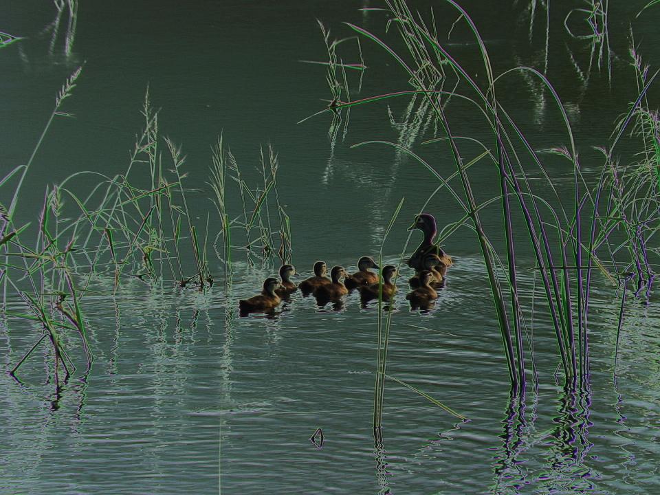
After seemingly worthless words were conveyed and the government building was left behind, Justin and I went to the La Platte Bottoms to see what might be around. It somehow seemed indicative that there were very few birds observed. There were a few Black Terns, a Pied-billed Grebe and American Coot, and a few Red-winged Blackbirds. The lack of birds vividly conveyed how - after a massive impact to the place by construction of a highway and interchange - there will probably never again be the bird diversity that can still be appreciated for a time.

The La Platte Bottoms setting will be destroyed due to the construction of a highway and interchange.

21 July 2010

Wetland Evening at the La Platte Bottoms

Tuesday evening, July 20th, was a fine time to visit the wetlands at the La Platte Bottoms. It was muggy and hot, but this is an expected situation at marsh lands during this time in the summer.

During the visit, the following species were noted: one Greater Yellowlegs, a female Wood Duck with her brood of 8 ducklings, about 14 Black Terns including one that carried a fish around for a short while, several American Coots and Pied-billed Grebes, two Belted Kingfisher sitting on the line while looking for a fish to catch. Also some Killdeer, a Sora heard among the marsh vegetation, more than a dozen Mallards including a family group of seven, as well as Red-winged Blackbirds at the wetland scene. Among the other species was an American Kestrel.

Mother Wood Duck and her fast swimming brood.

There was lots of standing water. An area bordered by the tree line on the west, La Platte Road on the north and the Missouri River levee on the east and south was inundated.

Looking west at the condition of LaPlatte Road.

On the north side of La Platte Road, and east of Harlan Lewis Road, the southern half was flooded, and was a favorite place for the Black Terns to forage, and the preferred place for the Greater Yellowlegs. West of Harlan Lewis Road, there was also a large area of standing water, which was where the Wood Duck brood was noted.

American Coot on the marsh waters, south of LaPlatte Road.

View of the standing water north of LaPlatte Road, and west of Harlan Lewis Road.

View of the standing water - with its wetland vegetation and where American Coots and Pied-billed Grebes were seen, and a Sora heard - south of La Platte Road. Looking to the southwest.

A variety of images taken on the scene were digitally altered to convey an artistic interpretation, which is another reason - besides bird and the joys they provide - to appreciate the La Platte Bottoms wetlands.

Sunset from Harlan Lewis Road.

20 July 2010

Planning Underway May Change Setting at La Platte Bottoms

Planning is currently underway that may transform the current setting at the La Platte Bottoms, according to information received from the Papio-Missouri River Natural Resources District.

Two particular changes being considered are moving the location of the flood-control levee and conservation of the wetlands.

The levees in the area are being recertified, according to a NRD official, and this is including an investigation into the possibility of realigning the levees, away from their current position along the north bank of the Platte River, and west bank of the Missouri River, about the confluence of these two historic rivers.

Levees might get moved so a greater portion of the bottoms would be on the river side of these earthen berms, the official said. The levees might follow a possible alignment from along the Platte south of the Gene Eppley Salvation Army Camp, then northward and along the eastern side of the unused PCS nitrogen facility, then eastward along La Platte Road, and then northeast to west of the confluence of the Big Papillion Creek, at the Missouri River.

Considerations by the NRD are preliminary at this time.

Also underway in the area, is an evaluation considering a contamination plume which has emanated from nitrogen plant, owned by PCS Nitrogen, which is no longer in business. The plume apparently developed due to production processes at the plant in past decades. The company owns much of the property eastward of their former facility, and south of La Platte Road.

"There has never been a better chance to do this project," according to the NRD official. "We are doing everything we can to have it go forward."

The effort would conserve the north section of the area about the confluence of the Platte and Missouri Rivers. On the south side is the Schilling Wildlife Management Area. To the west, is the sandpit operation of the Lyman Richey Sand and Gravel Company. The Saint Mary's Bend mitigation area is on the east side of the Missouri River.

Potential funding sources - for what could only be achieved through a partnership project - include the Missouri River Mitigation Project, being carried out by the U.S. Army Corps of Engineers, the Nebraska Environmental Trust, and others, perhaps including the Back to the River organization, and The Nature Conservancy.

Further particulars on the effort should be available this autumn.

06 July 2010

La Platte Bottoms Featured in Audubon Newsletter

The following article was written by Jerry Toll, current president of the Audubon Society of Omaha, for their newsletter, the Meadowlark. It is given here with his permission.

The La Platte wetlands have been a place for local birders to see migrating wetland birds for many years. Most years it holds water and attracts wading and shorebirds but being an ephemeral wetland in a dry spring, little water is there. This wet spring (and now summer) it has had plenty of standing water and has attracted impressive numbers and diversity. If you haven’t been there, it is located in southeastern Sarpy County south of Bellevue and east of the village of La Platte off Highway 75. A proposed highway bypass connecting I-29 in Iowa and the Highway 75 will pass through The La Platte wetlands. The current plan is to bisect the wetlands near where East La Platte Road turns north which is south of the Papio Creek. It will adversely affect the use of the wetland by wetland birds by fragmentation and brings heavy traffic into the wetland deterring bird usage. The filling of the roadway may have an effect on the hydrology of the wetlands but I have not seen any discussion on that perspective. The plan calls for close to 5 acres be mitigated but there is discussion that the area impacted is actually larger for which a 404 permit has not been issued. Jim Ducey who seems to be spearheading the effort to protect the wetland is recommending that the original 404 permit is invalided and is calling for a review which would include public hearings. Unfortunately, the Bypass project is well along and the monies for the Missouri River Bridge have already been appropriated through congress. Ducey is suggesting that the bridge be moved upstream closer to the Papio Creek thus greatly diminishing the impact on the La Platte wetlands. Another concern is the land under consideration to replace the mitigated wetland lost. It is located south of the Platte River sandwiched between a gravel pit operation with heavy train traffic and the old highway into Plattsmouth.

Loren and Babs Padelford had this to say in their letter to the Corp of Engineers. "The proposed mitigation site in Cass County is not as close to the Missouri and Platte Rivers. Also it is bordered on the north end by an active railroad line, which is a disturbing factor for migrating wildlife. The present wetland is very suitable for shorebirds because in dry years it’s cultivated. This is beneficial because it does not allow cottonwood trees and other heavy vegetation to grow up, thus keeping the habitat open and accessible for use by shorebirds and waterfowl. It seems that the farmland adjacent and to the west of the current wetland would have been a more appropriate site for mitigation because it also floods and is located near the present site in Sarpy County."